
0
documented records
≈ 600–1,200
approx. capacity (graves)
0.030 km²
cemetery area
Oct 18, 2026
last modified
About this cemetery
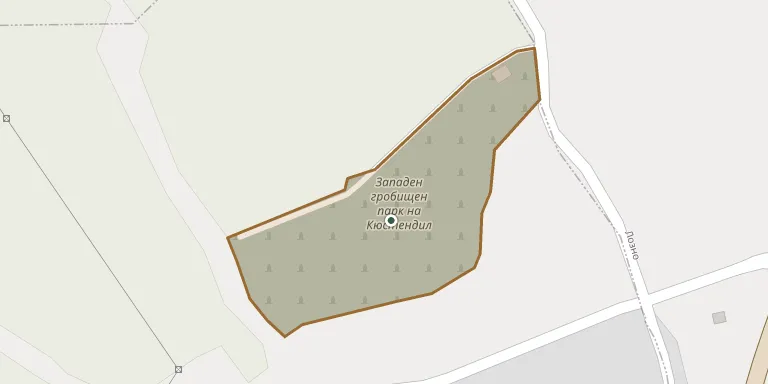
The original Jewish cemetery of Kyustendil stood on the left hill of the Adjundarski gorge, near the Katranlia district. In 1900 the cemetery moved to an adjacent location, which remained in use until 1951 and covers 1.9 hectares. The Jewish plot has been repeatedly vandalised.
Cemetery location
GPS coordinates: 42.280681° N, 22.652811° E Directions in Google Maps (opens in a new tab)
Memorials
No records yet
Photograph a headstone and add it to the archive.
Looking for someone who isn't listed? Request a photo.
Nearby cemeteries
The closest other burial grounds listed on EveryStone.
- Varteshevo New Town Cemetery, Zhilentsi 760 m away · Zhilentsi
- Buzludzha Cemetery, Kyustendil 4.5 km away · Kyustendil
- Central Kyustendil Cemetery 4.6 km away · Kyustendil
- Gerena Jewish Cemetery, Kyustendil 5.0 km away · Kyustendil
- Cemetery of Yabalkovo 8.1 km away · Yabalkovo
- Perivol Cemetery, Dragovishtitsa 10 km away · Dragovishtitsa
- Marvodol Cemetery 22 km away · Marvodol
- Bosilegrad Cemetery 26 km away · Rajčilovci
- Golyam Varbovnik Cemetery Park 26 km away · Golem Varbovnik
- Izvor Cemetery 27 km away · Izvor
Contribute with the app
Our website works smoothly on both desktop and mobile devices. Prefer a native app? Check it out below.
- Capture clear headstone photos
- Save GPS grave locations automatically
- Transcribe inscriptions with our AI
- Suggest corrections to existing records
Common questions
How big is Jewish Cemetery in Kyustendil?
Jewish Cemetery in Kyustendil covers about 30,000 m² (7.4 acres), about the size of 4 soccer fields. It is the 4th largest of the 19 cemeteries we list in Kyustendil.