
0
documented records
≈ 300–610
approx. capacity (graves)
0.015 km²
cemetery area
Oct 18, 2026
last modified
About this cemetery
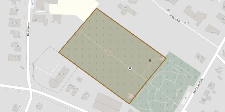
The cemetery in Stará Boleslav lies north of the Church of the Assumption of the Virgin Mary, between the streets Josefa Truhláře, Okružní and V. In the Middle Ages burials took place at the individual churches, a practice that continued until the Josephine reforms abolished it. The cemetery is being enlarged in two stages, which include new paved areas and a boundary wall.
Cemetery location
GPS: GPS coordinates: 50.201083° N, 14.679278° E Directions in Google Maps (opens in a new tab)
Memorials
No records yet
Photograph a headstone and add it to the archive.
Looking for someone who isn't listed? Request a photo.
Nearby cemeteries
The closest other burial grounds listed on EveryStone.
- Brandýs nad Labem-Stará Boleslav Cemetery 2.0 km away · Brandýs nad Labem-Stará Boleslav
- Brandýs nad Labem Jewish Cemetery 2.2 km away · Brandýs nad Labem-Stará Boleslav
- Zápy New Cemetery 3.8 km away · Zápy
- Zápy Old Cemetery 4.0 km away · Zápy
- Lázně Toušeň Cemetery 4.8 km away · Lázně Toušeň
- Dřevčice Cemetery near Brandýs nad Labem 4.9 km away · Dřevčice
- Skorkov Cemetery 6.0 km away · Skorkov
- Kostelní Hlavno Cemetery 6.4 km away · Kostelní Hlavno
- Svémyslice Cemetery 6.5 km away · Svémyslice
- Dřísy Cemetery 6.6 km away · Dřísy
Contribute with the app
Our website works smoothly on both desktop and mobile devices. Prefer a native app? Check it out below.
- Capture clear headstone photos
- Save GPS grave locations automatically
- Transcribe inscriptions with our AI
- Suggest corrections to existing records
Common questions
How big is Stará Boleslav Cemetery?
Stará Boleslav Cemetery covers about 15,000 m² (3.7 acres), about the size of 2 soccer fields. It is the 24th largest of the 906 cemeteries we list in Central Bohemian Region.