
0
documented records
≈ 74–150
approx. capacity (graves)
3,690 m²
cemetery area
Oct 18, 2026
last modified
About this cemetery
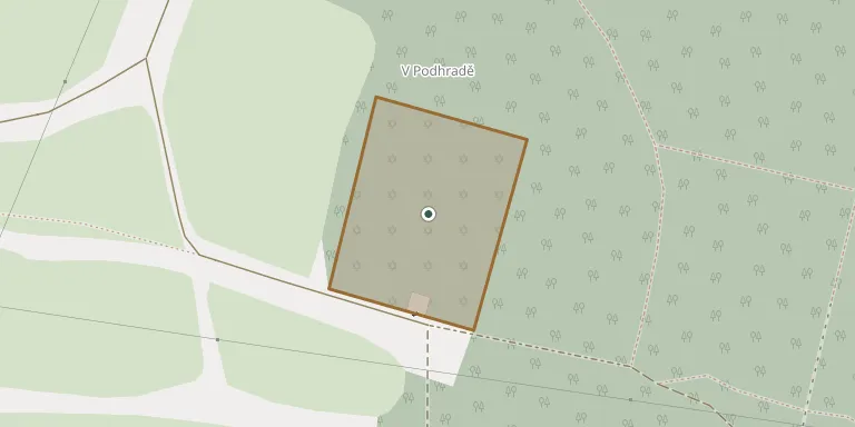
The Jewish cemetery in Humpolec lies in a wooded park below Orlík castle, about 900 metres east of the town centre. It is dated to 1716 and was later enlarged twice. Around 1,000 Baroque and later gravestones survive. The last burial took place in 1942, three months before the town's Jews were deported to Terezín.
Cemetery location
GPS: GPS coordinates: 49.542159° N, 15.371646° E Directions in Google Maps (opens in a new tab)
Memorials
No records yet
Photograph a headstone and add it to the archive.
Looking for someone who isn't listed? Request a photo.
Nearby cemeteries
The closest other burial grounds listed on EveryStone.
- Humpolec Cemetery 740 m away · Humpolec · 183 records
- Jiřice Cemetery 4.7 km away · Jiřice
- Skála u Havlíčkova Brodu Cemetery 4.8 km away · Věž · 32 records
- Mladé Bříště Cemetery 6.4 km away · Mladé Bříště · 12 records
- Herálec Cemetery near Havlíčkův Brod 6.5 km away · Herálec · 1 record
- Herálec Lower Cemetery near Havlíčkův Brod 6.7 km away · Herálec · 15 records
- Řečice Cemetery 6.8 km away · Řečice
- Herálec Upper Cemetery near Havlíčkův Brod 7.2 km away · Herálec · 83 records
- Kaliště Cemetery 7.6 km away · Kaliště
- Skorkov Cemetery near Herálec 7.9 km away · Skorkov · 46 records
Contribute with the app
Our website works smoothly on both desktop and mobile devices. Prefer a native app? Check it out below.
- Capture clear headstone photos
- Save GPS grave locations automatically
- Transcribe inscriptions with our AI
- Suggest corrections to existing records
Common questions
How big is Humpolec Jewish Cemetery?
Humpolec Jewish Cemetery covers about 3,690 m² (0.9 acres), about half the size of a soccer field. It is the 123rd largest of the 374 cemeteries we list in Vysočina Region.