
0
documented records
≈ 41–81
approx. capacity (graves)
2,030 m²
cemetery area
Oct 18, 2026
last modified
About this cemetery
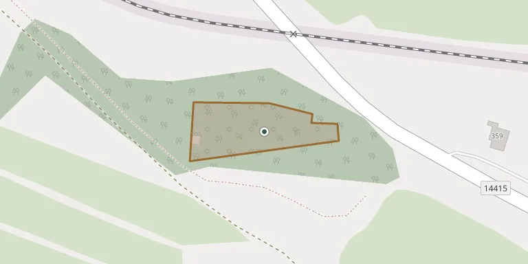
The Jewish cemetery in Čkyně was probably founded at the end of the 17th century and served the village and a wide surrounding area. It lies south of the village in a small wood above the railway line, and the oldest gravestone dates from 1688. Burials continued until 1942, when the local Jews were deported to concentration camps. The cemetery contains Baroque gravestones and an unusual mortuary building, and it has been repaired in recent years.
Cemetery location
GPS coordinates: 49.109903° N, 13.834862° E Directions in Google Maps (opens in a new tab)
Memorials
No records yet
Photograph a headstone and add it to the archive.
Looking for someone who isn't listed? Request a photo.
Nearby cemeteries
The closest other burial grounds listed on EveryStone.
- Čkyně Cemetery 1.1 km away · Čkyně · 17 records
- Bohumilice Cemetery 2.0 km away · Bohumilice
- Malenice Cemetery 3.8 km away · Malenice
- Čestice Cemetery 3.9 km away · Čestice
- Nahořany Evangelical Cemetery 3.9 km away · Nahořany
- Svatá Maří Cemetery 5.1 km away · Svatá Maří
- Radhostice-Lštění Cemetery near Radhostice 5.6 km away · Radhostice
- Volyně Cemetery 6.7 km away · Volyně · 33 records
- Čestice Cemetery 6.9 km away · Čestice
- Volyně Jewish Cemetery 7.2 km away · Volyně
Contribute with the app
Our website works smoothly on both desktop and mobile devices. Prefer a native app? Check it out below.
- Capture clear headstone photos
- Save GPS grave locations automatically
- Transcribe inscriptions with our AI
- Suggest corrections to existing records
Common questions
How big is Čkyně Jewish Cemetery?
Čkyně Jewish Cemetery covers about 2,030 m² (0.5 acres), about the size of 8 tennis courts. It is the 164th smallest of the 395 cemeteries we list in South Bohemian Region.