
0
documented records
≈ 32–63
approx. capacity (graves)
1,580 m²
cemetery area
Oct 18, 2026
last modified
About this cemetery
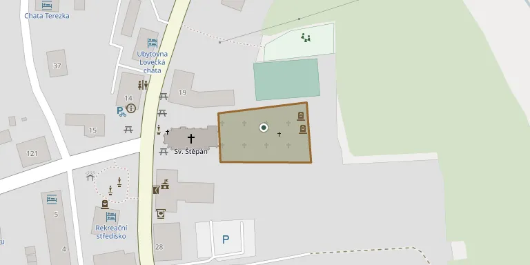
The cemetery at Kvilda was founded in 1765 together with the original church, after the Prague archiepiscopal consistory gave permission for its construction. The wooden church of St Stephen burned down in 1889, and a stone church was consecrated in 1894. Until the end of the Second World War mostly German-speaking residents were buried here. The cemetery was destroyed in 1978, and in 2004 gravestones recovered from a dump were returned to the site.
Cemetery location
GPS coordinates: 49.019245° N, 13.580319° E Directions in Google Maps (opens in a new tab)
Memorials
No records yet
Photograph a headstone and add it to the archive.
Looking for someone who isn't listed? Request a photo.
Nearby cemeteries
The closest other burial grounds listed on EveryStone.
- Nové Hutě Cemetery - Kaltenbach 5.4 km away · Nové Hutě · 9 records
- Borová Lada Cemetery, Nový Svět 6.6 km away · Borová Lada
- Knížecí Pláně Cemetery 7.9 km away · Knížecí Pláně
- Mater Dolorosa Cemetery 10.0 km away · Finsterau
- Stachy Cemetery 11 km away · Stachy
- Zdíkov Cemetery 12 km away · Zdíkov · 36 records
- Nicov Cemetery 12 km away · Nicov · 2 records
- Rejštejn Cemetery 14 km away · Rejštejn
- Mauth Cemetery 14 km away · Mauth
- Kašperské Hory Cemetery 15 km away · Kašperské Hory · 13 records
Contribute with the app
Our website works smoothly on both desktop and mobile devices. Prefer a native app? Check it out below.
- Capture clear headstone photos
- Save GPS grave locations automatically
- Transcribe inscriptions with our AI
- Suggest corrections to existing records
Common questions
How big is Kvilda Cemetery?
Kvilda Cemetery covers about 1,580 m² (0.4 acres), about the size of 6 tennis courts. It is the 120th smallest of the 395 cemeteries we list in South Bohemian Region.