
0
documented records
≈ 1,900–3,700
approx. capacity (graves)
0.094 km²
cemetery area
Oct 18, 2026
last modified
About this cemetery
Opened in 1879, the Municipal Cemetery in Cheb is an extensive complex. The entrance is formed by an administration building with a neo-Gothic cemetery chapel, and further rooms serve the cemetery management. The grounds contain tombs of notable residents of the town. The cemetery's telephone number is +420 737 234 012, and you can find out more through cheb.cz.
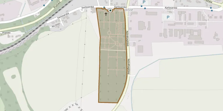
Cemetery location
GPS coordinates: 50.084928° N, 12.397036° E Directions in Google Maps (opens in a new tab)
Memorials
No records yet
Photograph a headstone and add it to the archive.
Looking for someone who isn't listed? Request a photo.
Nearby cemeteries
The closest other burial grounds listed on EveryStone.
- Cheb Cemetery, Hradiště near Cheb 180 m away · Cheb · 2 records
- Cheb German War Cemetery 1939–1945 220 m away · Cheb · 206 records
- Podhrad War Cemetery at the Prisoner-of-War Camp 3.2 km away · Cheb
- Cheb Cemetery, Dřenice near Cheb 4.0 km away · Cheb
- Třebeň Cemetery 4.5 km away · Třebeň
- Dolní Pelhřimov Cemetery 5.8 km away · Svatá Anna
- Nebanice Cemetery 6.5 km away · Nebanice · 13 records
- Starý Hrozňatov Symbolic Cemetery 6.6 km away · Starý Hrozňatov
- Františkovy Lázně Cemetery 6.7 km away · Horní Lomany
- Horní Lomany Jewish Cemetery (for Františkovy Lázně) 6.7 km away · Dolní Lomany
Contribute with the app
Our website works smoothly on both desktop and mobile devices. Prefer a native app? Check it out below.
- Capture clear headstone photos
- Save GPS grave locations automatically
- Transcribe inscriptions with our AI
- Suggest corrections to existing records
Common questions
How big is Cheb Municipal Cemetery?
Cheb Municipal Cemetery covers about 94,000 m² (23 acres), about the size of 13 soccer fields. It is the largest of the 153 cemeteries we list in Karlovy Vary Region.