
Cemetery #310239
Šumperk Jewish Cemetery
Local name: Židovský hřbitov, Šumperk
Also known as Židovský hřbitov v Šumperku
0
documented records
≈ 34–68
approx. capacity (graves)
1,700 m²
cemetery area
Oct 18, 2026
last modified
About this cemetery
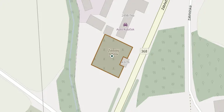
The Jewish cemetery lies on the south-western edge of Šumperk, on Zábřežská street about 2 km from the centre. It was founded in 1910 and used until 1942. The site is dominated by a two-storey ceremonial hall with a passage and an Art Nouveau hall designed by the architect Hugo Nader. About 34 to 35 gravestones survive, the cemetery belongs to the Federation of Jewish Communities in the Czech Republic, and it has been a protected cultural monument since 15 December 1995.
Cemetery location
GPS coordinates: 49.948248° N, 16.954328° E Directions in Google Maps (opens in a new tab)
Memorials
No records yet
Photograph a headstone and add it to the archive.
Looking for someone who isn't listed? Request a photo.
Nearby cemeteries
The closest other burial grounds listed on EveryStone.
- Šumperk Municipal Cemetery 550 m away · Šumperk · 141 records
- Dolní Studénky Cemetery 2.1 km away · Dolní Studénky · 9 records
- Bludov Cemetery 2.4 km away · Bludov · 158 records
- Šumperk Cemetery 2.9 km away · Šumperk · 39 records
- Kolšov Cemetery 4.6 km away · Kolšov
- Chromeč Cemetery 4.7 km away · Chromeč
- Dlouhomilov Cemetery 5.1 km away · Dlouhomilov
- Nový Malín Cemetery 5.6 km away · Nový Malín
- Postřelmov Cemetery 5.7 km away · Postřelmov
- Hrabišín Cemetery 5.9 km away · Dolní Olešná
Contribute with the app
Our website works smoothly on both desktop and mobile devices. Prefer a native app? Check it out below.
- Capture clear headstone photos
- Save GPS grave locations automatically
- Transcribe inscriptions with our AI
- Suggest corrections to existing records
Common questions
How big is Šumperk Jewish Cemetery?
Šumperk Jewish Cemetery covers about 1,700 m² (0.4 acres), about the size of 6 tennis courts. It is the 114th smallest of the 413 cemeteries we list in Olomouc Region.