
Cemetery #310242
Vyškov Jewish Cemetery
Local name: Židovský hřbitov, Vyškov
Also known as Židovský hřbitov ve Vyškově
0
documented records
≈ 69–140
approx. capacity (graves)
3,430 m²
cemetery area
Oct 18, 2026
last modified
About this cemetery
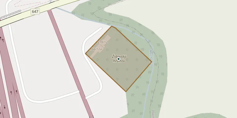
The cemetery was founded in 1888 in the Marchanice locality, about 1.5 km east of the former synagogue on Kroměřížská street. The first burial probably took place in 1891. Of its original area of 3,174 m², it now holds about 59 to 60 preserved tombstones.
Cemetery location
GPS coordinates: 49.281665° N, 17.022537° E Directions in Google Maps (opens in a new tab)
Memorials
No records yet
Photograph a headstone and add it to the archive.
Looking for someone who isn't listed? Request a photo.
Nearby cemeteries
The closest other burial grounds listed on EveryStone.
- Vyškov Cemetery 10 m away · Vyškov
- Topolany Cemetery 1.2 km away · Topolany · 41 records
- Vyškov Cemetery 2.1 km away · Vyškov · 284 records
- Vyškov Dědice Cemetery near Vyškov 3.1 km away · Vyškov · 156 records
- Hoštice-Heroltice Cemetery 3.5 km away · Hoštice
- Prusy-Boškůvky Cemetery 4.3 km away · Prusy-Boškůvky · 99 records
- Ivanovice na Hané New Cemetery 4.7 km away · Ivanovice na Hané · 104 records
- Medlovice Cemetery 4.9 km away · Medlovice
- Pustiměř Cemetery 5.0 km away · Pustiměř · 27 records
- Drnovice Cemetery 5.0 km away · Drnovice
Contribute with the app
Our website works smoothly on both desktop and mobile devices. Prefer a native app? Check it out below.
- Capture clear headstone photos
- Save GPS grave locations automatically
- Transcribe inscriptions with our AI
- Suggest corrections to existing records
Common questions
How big is Vyškov Jewish Cemetery?
Vyškov Jewish Cemetery covers about 3,430 m² (0.8 acres), about half the size of a soccer field. It is the 244th largest of the 569 cemeteries we list in South Moravian Region.