
0
documented records
≈ 46–91
approx. capacity (graves)
2,280 m²
cemetery area
Oct 18, 2026
last modified
About this cemetery
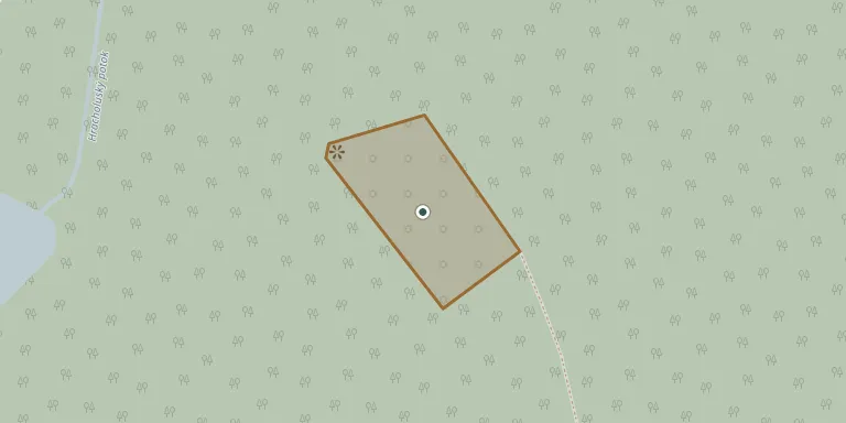
The Jewish cemetery lies in a forest south of Pňovany, beyond the Hracholusky stream, and is protected as a cultural monument. It is said to have been founded in the 16th century but is documented from the second half of the 17th. The oldest recorded gravestone dates from 1726. The cemetery was devastated by the Nazis.
Cemetery location
GPS coordinates: 49.772748° N, 13.124155° E Directions in Google Maps (opens in a new tab)
Memorials
No records yet
Photograph a headstone and add it to the archive.
Looking for someone who isn't listed? Request a photo.
Nearby cemeteries
The closest other burial grounds listed on EveryStone.
- Jezná Old Catholic Cemetery 1.2 km away · Úlice
- Úlice Cemetery 1.6 km away · Jezná
- Sulislav Cemetery 4.6 km away · Sulislav
- Erpužice Cemetery 6.8 km away · Erpužice
- Blatnice Cemetery 6.8 km away · Blatnice
- Pernarec Cemetery 7.4 km away · Pernarec
- Líšťany Cemetery 8.2 km away · Líšľany
- Heřmanova Huť Cemetery, Horní Sekyřany 8.3 km away · Heřmanova Huť
- Město Touškov Jewish Cemetery 8.3 km away · Město Touškov
- Město Touškov Cemetery 8.6 km away · Město Touškov · 5 records
Contribute with the app
Our website works smoothly on both desktop and mobile devices. Prefer a native app? Check it out below.
- Capture clear headstone photos
- Save GPS grave locations automatically
- Transcribe inscriptions with our AI
- Suggest corrections to existing records
Common questions
How big is Pňovany Jewish Cemetery?
Pňovany Jewish Cemetery covers about 2,280 m² (0.6 acres), about the size of 9 tennis courts. It is the 180th smallest of the 410 cemeteries we list in Plzeň Region.