
0
documented records
≈ 960–1,900
approx. capacity (graves)
0.048 km²
cemetery area
Oct 18, 2026
last modified
About this cemetery
Until 1910 the Jews of Vrchlabí buried their dead in Hořice. In 1910 a Jewish section of the town cemetery was created to a design by local builder Kleofáš Hollman, and by the end of the First Republic it held about 40 graves. It was devastated during the Protectorate, and on 9 May 1945 the Gestapo shot and buried six Russian prisoners there. After the war the town sold the gravestones and levelled the site, and it no longer exists.
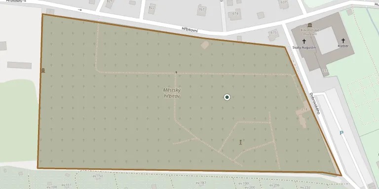
Cemetery location
GPS coordinates: 50.628097° N, 15.603958° E Directions in Google Maps (opens in a new tab)
Memorials
No records yet
Photograph a headstone and add it to the archive.
Looking for someone who isn't listed? Request a photo.
Nearby cemeteries
The closest other burial grounds listed on EveryStone.
- Vrchlabí Cemetery 30 m away · Vrchlabí · 45 records
- Horní Branná Cemetery 3.2 km away · Bohdaneč · 9 records
- Horní Branná-Valteřice Cemetery 3.5 km away · Horní Branná
- Dolní Branná Cemetery 3.6 km away · Dolní Branná
- Dolní Branná Cemetery 4.3 km away · Dolní Branná · 3 records
- Dolní Lánov Cemetery, Lánov 4.7 km away · Lánov
- Dolní Dvůr Cemetery 4.7 km away · Dolní Dvůr
- Benecko-Horní Štěpanice Catholic Cemetery 4.9 km away · Benecko · 11 records
- Benecko-Horní Štěpanice Evangelical Cemetery 4.9 km away · Benecko · 6 records
- Kunčice nad Labem Cemetery 5.4 km away · Kunčice nad Labem
Contribute with the app
Our website works smoothly on both desktop and mobile devices. Prefer a native app? Check it out below.
- Capture clear headstone photos
- Save GPS grave locations automatically
- Transcribe inscriptions with our AI
- Suggest corrections to existing records
Common questions
How big is Vrchlabí Jewish Cemetery?
Vrchlabí Jewish Cemetery covers about 48,000 m² (12 acres), about the size of 7 soccer fields. It is the 4th largest of the 466 cemeteries we list in Hradec Králové Region.