
Cemetery #311896
De Drinkeldodenkarkhof
Also known as Friedhof der Heimatlosen · Drinkeldodenkarkhoff
0
documented records
≈ 9–18
approx. capacity (graves)
450 m²
cemetery area
Oct 18, 2026
last modified
About this cemetery
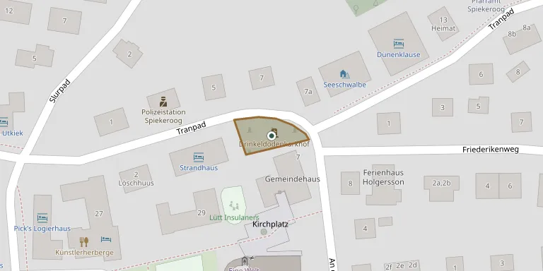
The name is Low German for cemetery of the drowned, and it is also called the cemetery of the homeless. It lies on Tranpad on the island of Spiekeroog and commemorates the victims of the emigrant ship Johanne, which stranded off the island on 6 November 1854. Of the 77 emigrants who lost their lives, the recovered dead were buried here on 9 November in a dune valley then outside the village.
Cemetery location
GPS coordinates: 53.771695° N, 7.700424° E Directions in Google Maps (opens in a new tab)
Memorials
No records yet
Photograph a headstone and add it to the archive.
Looking for someone who isn't listed? Request a photo.
Nearby cemeteries
The closest other burial grounds listed on EveryStone.
- Spiekeroog Cemetery 440 m away · Spiekeroog
- Carolinensiel Evangelical Lutheran Cemetery 11 km away · Wittmund
- Nordseeheilbad Wangerooge War Graves 12 km away · Nordseeheilbad Wangerooge
- Nordseeheilbad Wangerooge Island Cemetery 13 km away · Nordseeheilbad Wangerooge
- Werdum Old Cemetery 13 km away · Werdum
- Warfe Cemetery 13 km away · Werdum
- Langeoog Dune Cemetery 14 km away · Langeoog
- Langeoog Soviet Cemetery 14 km away · Langeoog
- Thunum Cemetery 14 km away · Thunum
- Endzetel Private Cemetery 14 km away · Endzetel
Contribute with the app
Our website works smoothly on both desktop and mobile devices. Prefer a native app? Check it out below.
- Capture clear headstone photos
- Save GPS grave locations automatically
- Transcribe inscriptions with our AI
- Suggest corrections to existing records
Common questions
How big is De Drinkeldodenkarkhof?
De Drinkeldodenkarkhof covers about 450 m² (0.1 acres), about the size of 2 tennis courts. It is the 69th smallest of the 3,526 cemeteries we list in Lower Saxony.