
Cemetery #313254
Bad Ems Cemetery
Local name: Friedhof Bad Ems
Also known as Bad Ems Jewish Cemetery · Jüdischer Friedhof Bad Ems
0
documented records
≈ 540–1,100
approx. capacity (graves)
0.027 km²
cemetery area
Oct 8, 2026
last modified
About this cemetery
The Jewish cemetery in Bad Ems was laid out around 1880 and covers 13.66 ares. Jewish spa guests visiting the town were also buried here. Its Taharah house dates from about 1881 and was extended in 1929 at the instigation of Ludolf Rosenheim, and plaques recall the victims of Nazi persecution from 1933 to 1945. Its telephone number is +49 2603 7930.
Cemetery location
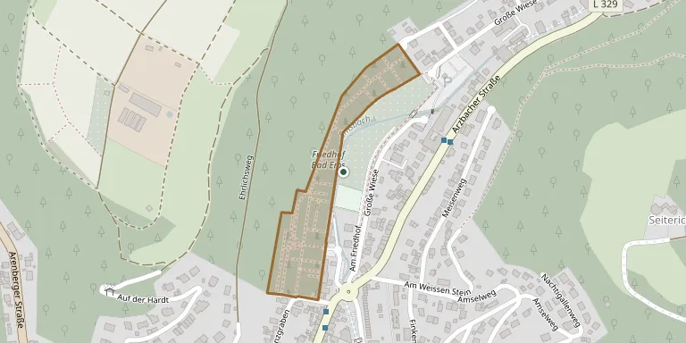
GPS coordinates: 50.340634° N, 7.713893° E Directions in Google Maps (opens in a new tab)
Memorials
No records yet
Photograph a headstone and add it to the archive.
Looking for someone who isn't listed? Request a photo.
Nearby cemeteries
The closest other burial grounds listed on EveryStone.
- Fachbach Cemetery 1.9 km away · Fachbach
- Nievern Cemetery 2.3 km away · Nievern
- Kemmenau Cemetery 2.5 km away · Kemmenau
- Dausenau Cemetery 3.5 km away · Dausenau
- St. Kastorkirche Cemetery 3.5 km away · Dausenau
- Miellen Cemetery 3.5 km away · Miellen
- Eitelborn Cemetery 3.6 km away · Eitelborn
- Frücht Cemetery 4.1 km away · Frücht
- Arzbach Cemetery 4.4 km away · Arzbach
- Koblenz Miners' Cemetery 4.5 km away · Koblenz
Contribute with the app
Our website works smoothly on both desktop and mobile devices. Prefer a native app? Check it out below.
- Capture clear headstone photos
- Save GPS grave locations automatically
- Transcribe inscriptions with our AI
- Suggest corrections to existing records
Common questions
How big is Bad Ems Cemetery?
Bad Ems Cemetery covers about 27,000 m² (6.7 acres), about the size of 4 soccer fields. It is the 96th largest of the 3,001 cemeteries we list in Rhineland-Palatinate.