
Cemetery #313730
Bocholt Cemetery
Local name: Friedhof Bocholt
Also known as Bocholt Municipal Cemetery · Städtischer Friedhof
0
documented records
≈ 4,900–9,800
approx. capacity (graves)
0.245 km²
cemetery area
Oct 7, 2026
last modified
About this cemetery
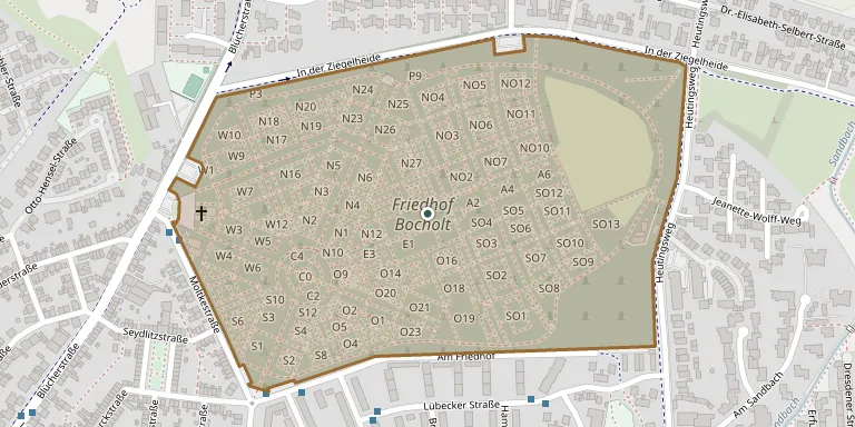
The large municipal cemetery of Bocholt, on Blücherstraße, was designed in 1904 by city building councillor Friedrich Hermann Kraatz in a strictly geometric layout. In 1908 it replaced the old cemetery, which was later converted into the Langenbergpark. It was landscaped and extended in the 1920s under Wilhelm Brockhoff, and its core is traversed by two diagonal avenues of lime and trimmed plane trees.
Cemetery location
GPS coordinates: 51.842844° N, 6.639754° E Directions in Google Maps (opens in a new tab)
Memorials
No records yet
Photograph a headstone and add it to the archive.
Looking for someone who isn't listed? Request a photo.
Nearby cemeteries
The closest other burial grounds listed on EveryStone.
- Ehrenanlage Gefallene 1. und 2. Weltkrieg 20 m away · Bocholt
- Muslimische Gräber 240 m away · Bocholt
- Bocholt Jewish Cemetery 1.2 km away · Bocholt
- Bocholt Russian Cemetery 1.2 km away · Bocholt
- Rhede Cemetery 3.0 km away · Rhede
- Rhede Old Cemetery 3.4 km away · Rhede
- Barlo Catholic Cemetery 5.0 km away · Barlo
- Mussum Catholic Cemetery 5.0 km away · Bocholt
- Spork Catholic Cemetery 5.6 km away · Spork
- Liedern Cemetery 6.0 km away · Bocholt
Contribute with the app
Our website works smoothly on both desktop and mobile devices. Prefer a native app? Check it out below.
- Capture clear headstone photos
- Save GPS grave locations automatically
- Transcribe inscriptions with our AI
- Suggest corrections to existing records
Common questions
How big is Bocholt Cemetery?
Bocholt Cemetery covers about 24.5 hectares (245,000 m²), about the same size as Powązki Military Cemetery in Warsaw. It is the 47th largest of the 4,061 cemeteries we list in North Rhine-Westphalia.