
Cemetery #318918
Niederrad Cemetery
Local name: Friedhof Niederrad
Also known as Grabmäler auf dem Stadtteilfriedhof Niederrad
0
documented records
≈ 790–1,600
approx. capacity (graves)
0.039 km²
cemetery area
Oct 18, 2026
last modified
About this cemetery
The cemetery on Hahnstraße has served the Frankfurt am Main district of Niederrad since 1881. It opened while Niederrad was still an independent village, well before it was merged into Frankfurt. Questions about visits or burials can go to +49 69 21240354; more information is available from friedhof-frankfurt.de.
Cemetery location
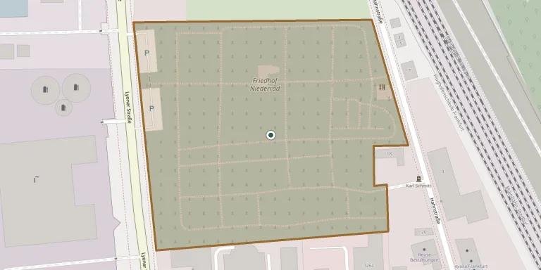
GPS coordinates: 50.086036° N, 8.630614° E Directions in Google Maps (opens in a new tab)
Memorials
No records yet
Photograph a headstone and add it to the archive.
Looking for someone who isn't listed? Request a photo.
Nearby cemeteries
The closest other burial grounds listed on EveryStone.
- Goldstein Woodland Cemetery 2.3 km away · Frankfurt
- Frankfurt am Main War Graves 2.7 km away · Frankfurt am Main
- Griesheim Cemetery 2.8 km away · Frankfurt am Main
- Griesheim Jewish Cemetery 2.8 km away · Frankfurt am Main
- Schwanheim Old Cemetery 4.1 km away · Frankfurt am Main
- Evangelische St. Jakobskirche, Frankfurt 4.5 km away · Frankfurt
- Bockenheim Jewish Cemetery 4.5 km away · Frankfurt
- Sachsenhausen South Cemetery 4.5 km away · Frankfurt · 22 records
- Rödelheim Cemetery 4.6 km away · Frankfurt am Main (Dom) · 303 records
- Rödelheim Jewish Cemetery 4.6 km away · Frankfurt am Main · 9 records
Contribute with the app
Our website works smoothly on both desktop and mobile devices. Prefer a native app? Check it out below.
- Capture clear headstone photos
- Save GPS grave locations automatically
- Transcribe inscriptions with our AI
- Suggest corrections to existing records
Common questions
How big is Niederrad Cemetery?
Niederrad Cemetery covers about 39,000 m² (9.7 acres), about the size of 5 soccer fields. It is the 110th largest of the 3,180 cemeteries we list in Hesse.