
0
documented records
≈ 48–97
approx. capacity (graves)
2,420 m²
cemetery area
Oct 18, 2026
last modified
About this cemetery
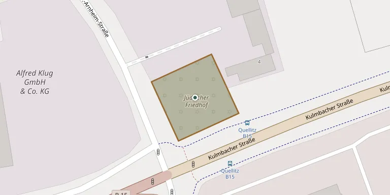
Established in 1911 on the Hohe Saas, on the road towards Wölbattendorf at the western edge of Hof, this cemetery covers 27 ares and is the youngest Jewish cemetery in Upper Franconia. Only remains of its Taharah house survive. After a new Jewish community formed in Hof following 1945, the cemetery was returned to its purpose. For enquiries, call +49 9281 8150 or see hof.de.
Cemetery location
GPS coordinates: 50.311770° N, 11.874021° E Directions in Google Maps (opens in a new tab)
Memorials
No records yet
Photograph a headstone and add it to the archive.
Looking for someone who isn't listed? Request a photo.
Nearby cemeteries
The closest other burial grounds listed on EveryStone.
- Köditz Cemetery 3.1 km away · Köditz
- Hof Cemetery, Plauener Straße 3.6 km away · Hof · 27 records
- Moschendorf Cemetery 4.7 km away · Moschendorf
- Konradsreuth Cemetery 5.4 km away · Konradsreuth
- Tauperlitz Cemetery 5.8 km away · Hof
- Leupoldsgrün Cemetery 5.9 km away · Leupoldsgrün
- Döhlau Cemetery 6.3 km away · Döhlau
- Oberkotzau Cemetery 6.8 km away · Oberkotzau
- Joditz Cemetery 7.0 km away · Joditz
- Selbitz Woodland Cemetery 7.9 km away · Selbitz
Contribute with the app
Our website works smoothly on both desktop and mobile devices. Prefer a native app? Check it out below.
- Capture clear headstone photos
- Save GPS grave locations automatically
- Transcribe inscriptions with our AI
- Suggest corrections to existing records
Common questions
How big is Hof Jewish Cemetery?
Hof Jewish Cemetery covers about 2,420 m² (0.6 acres), about the size of 9 tennis courts. It is the 2,431st smallest of the 5,401 cemeteries we list in Bavaria.