
Cemetery #323953
Georgensgmünd Jewish Cemetery
Local name: Jüdischer Friedhof, Georgensgmünd
Also known as Jüdischer Friedhof in Georgensgmünd
0
documented records
≈ 230–450
approx. capacity (graves)
0.011 km²
cemetery area
Oct 18, 2026
last modified
About this cemetery
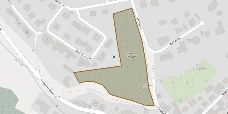
Jakob von Roth is said to have acquired the first plot before 1582, and the municipality gives the cemetery's founding as between 1559 and 1582; another source suggests it may date from 1515. It became a regional cemetery for Jewish communities of the area. It lies at the north-western edge of the village, where the former Taharah house stands at Judenbastei 9. Visitors can ring +49 9172 7030 or check georgensgmuend.de.
Cemetery location
GPS: 49.189585° N, 11.012476° E Directions in Google Maps (opens in a new tab)
Memorials
No records yet
Photograph a headstone and add it to the archive.
Looking for someone who isn't listed? Request a photo.
Nearby cemeteries
The closest other burial grounds listed on EveryStone.
- Am Mühlbuck 5 Cemetery 210 m away · Georgensgmünd
- Rittersbach Cemetery 3.4 km away · Rittersbach
- Mühlstetten Cemetery 3.9 km away · Mühlstetten
- Mäbenberg Woodland Cemetery 4.0 km away · Mäbenberg
- Röttenbach Cemetery 4.5 km away · Röttenbach
- Stirn Cemetery 5.4 km away · Stirn
- Großweingarten Cemetery 5.5 km away · Großweingarten
- Spalt Municipal Cemetery 6.4 km away · Spalt
- Wallesau Cemetery 7.0 km away · Wallesau
- Abenberg Cemetery 7.2 km away · Abenberg
Contribute with the app
Our website works smoothly on both desktop and mobile devices. Prefer a native app? Check it out below.
- Capture clear headstone photos
- Save GPS grave locations automatically
- Transcribe inscriptions with our AI
- Suggest corrections to existing records
Common questions
How big is Georgensgmünd Jewish Cemetery?
Georgensgmünd Jewish Cemetery covers about 11,000 m² (2.8 acres), about the size of 2 soccer fields. It is the 580th largest of the 5,401 cemeteries we list in Bavaria.