
Cemetery #324129
Oberhammerstein Jewish Cemetery
Local name: Jüdischer Friedhof, Oberhammerstein
0
documented records
≈ 64–130
approx. capacity (graves)
3,190 m²
cemetery area
Oct 18, 2026
last modified
About this cemetery
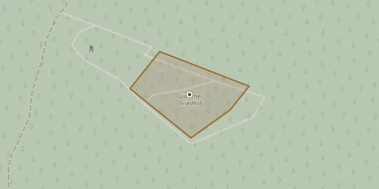
The Jewish cemetery near Hammerstein lies in woodland south-east of Oberhammerstein. It was used from the 17th century until 1902, mainly for Jews from Leutesdorf. It was desecrated by SS men in 1934 and during the November pogrom of 1938, and has been a protected cultural monument since 1989. More about the cemetery can be found through hammerstein-am-rhein.de.
Cemetery location
GPS coordinates: 50.470589° N, 7.362755° E Directions in Google Maps (opens in a new tab)
Memorials
No records yet
Photograph a headstone and add it to the archive.
Looking for someone who isn't listed? Request a photo.
Nearby cemeteries
The closest other burial grounds listed on EveryStone.
- Hammerstein Cemetery 800 m away · Oberhammerstein
- Namedy Mennonite Cemetery 1,000 m away · Namedy
- Namedy Cemetery 1.9 km away · Namedy
- Leutesdorf Cemetery 2.6 km away · Leutesdorf
- Brohl-Lützing Cemetery 3.1 km away · Brohl-Lützing · 2 records
- St. Suitbert Cemetery 3.4 km away · Rheinbrohl
- Rheinbrohl Cemetery 3.7 km away · Rheinbrohl
- Familie Dr. Rudolf Kerstiens 3.9 km away · Niederlützingen
- Niederbreisig Evangelical Cemetery 4.0 km away · Rheineck
- Rheinbrohl Jewish Cemetery 4.1 km away · Rheinbrohl
Contribute with the app
Our website works smoothly on both desktop and mobile devices. Prefer a native app? Check it out below.
- Capture clear headstone photos
- Save GPS grave locations automatically
- Transcribe inscriptions with our AI
- Suggest corrections to existing records
Common questions
How big is Oberhammerstein Jewish Cemetery?
Oberhammerstein Jewish Cemetery covers about 3,190 m² (0.8 acres), about half the size of a soccer field. It is the 1,457th smallest of the 3,001 cemeteries we list in Rhineland-Palatinate.