
0
documented records
≈ 82–160
approx. capacity (graves)
4,080 m²
cemetery area
Oct 18, 2026
last modified
About this cemetery
The Jewish cemetery in Sögel, in the Emsland district of Lower Saxony, was recorded in 1858 with an area of 2,120 square metres. It was desecrated in the Nazi period and probably devastated further in the November pogroms of 1938. Since 1959 it has belonged to the state association of Jewish communities of Lower Saxony, and it is a protected monument. For enquiries, call +49 5952 2060 or see soegel.de.
Cemetery location
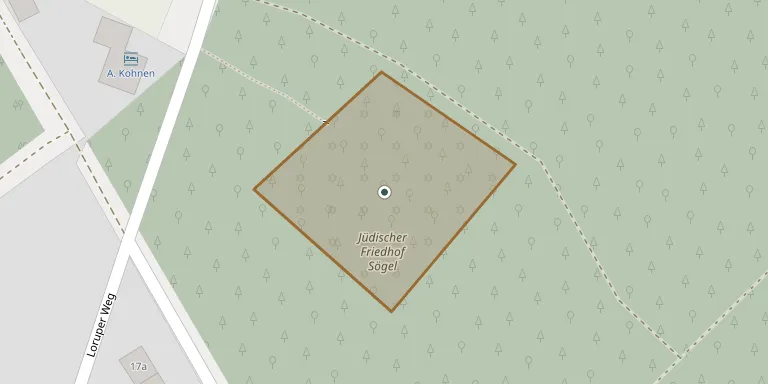
GPS: GPS coordinates: 52.848219° N, 7.529231° E Directions in Google Maps (opens in a new tab)
Memorials
No records yet
Photograph a headstone and add it to the archive.
Looking for someone who isn't listed? Request a photo.
Nearby cemeteries
The closest other burial grounds listed on EveryStone.
- Sögel Cemetery 640 m away · Sögel
- Bestattungswald „Spahner Südholz“ 2.9 km away · Spahn
- Werpeloh Cemetery 3.2 km away · Werpeloh
- Ostenwalde Urn Cemetery 4.1 km away · Ostenwalde
- Großsteingrab Ostenwalde 4.2 km away · Ostenwalde
- Steingrab Ostenwalde 4.5 km away · Ostenwalde
- St. Johannes der Täufer 5.3 km away · Spahnharrenstätte
- Wahn Cemetery 6.4 km away · Sögel
- Börger Cemetery 6.6 km away · Börger
- Lahn Cemetery 6.8 km away · Lahn
Contribute with the app
Our website works smoothly on both desktop and mobile devices. Prefer a native app? Check it out below.
- Capture clear headstone photos
- Save GPS grave locations automatically
- Transcribe inscriptions with our AI
- Suggest corrections to existing records
Common questions
How big is Sögel Jewish Cemetery?
Sögel Jewish Cemetery covers about 4,080 m² (1 acre), about half the size of a soccer field. It is the 1,194th smallest of the 3,526 cemeteries we list in Lower Saxony.