
Cemetery #325086
Werdener Straße Jewish Cemetery
Local name: Jüdischer Friedhof Werdener Straße
0
documented records
≈ 890–1,800
approx. capacity (graves)
0.044 km²
cemetery area
Oct 18, 2026
last modified
About this cemetery
The Jewish cemetery at Werdener Straße and Angerstraße in Ratingen was laid out in the 18th century, before 1783, and used until 1937. Ratingen's Jewish community existed continuously from the late 16th century until the Nazi era. A memorial site on the grounds was redesigned in 2013. Its phone number is +49 2051 965422, and more can be read on kirchengemeinde.evangelischer-friedhof.de.
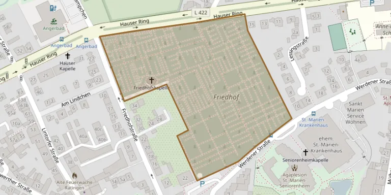
Cemetery location
GPS coordinates: 51.299484° N, 6.849825° E Directions in Google Maps (opens in a new tab)
Memorials
No records yet
Photograph a headstone and add it to the archive.
Looking for someone who isn't listed? Request a photo.
Nearby cemeteries
The closest other burial grounds listed on EveryStone.
- Ratingen Catholic Cemetery 230 m away · Ratingen
- Ratingen Woodland Cemetery 1.9 km away · Ratingen
- Ratingen Municipal Cemetery, Eggerscheidt 2.7 km away · Ratingen
- Tiefenbroich Cemetery 2.7 km away · Tiefenbroich
- Ruhewald Lintorfer Mark 3.8 km away · Knäpchen
- Lintorf Cemetery 4.2 km away · Knäpchen
- Homberg Cemetery 5.1 km away · Homberg
- Unterrath Monastery Cemetery 5.3 km away · Düsseldorf
- Düsseldorf Monastery Cemetery 5.4 km away · Düsseldorf
- Angermund Cemetery 5.7 km away · Düsseldorf
Contribute with the app
Our website works smoothly on both desktop and mobile devices. Prefer a native app? Check it out below.
- Capture clear headstone photos
- Save GPS grave locations automatically
- Transcribe inscriptions with our AI
- Suggest corrections to existing records
Common questions
How big is Werdener Straße Jewish Cemetery?
Werdener Straße Jewish Cemetery covers about 44,000 m² (11 acres), about the size of 6 soccer fields. It is the 495th largest of the 4,061 cemeteries we list in North Rhine-Westphalia.