
0
documented records
≈ 1,600–3,200
approx. capacity (graves)
0.081 km²
cemetery area
Oct 18, 2026
last modified
About this cemetery
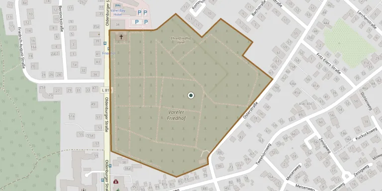
The cemetery in Varel dates from the mid-19th century, and in 1857 it became the town's central place of remembrance. Until about 1600 burials took place on the church hill beside the Schlosskirche, after which an older cemetery was used on the present Hindenburgstraße. The grounds cover about 9 hectares, among the largest of the Oldenburg regional church's cemeteries, and are run by the Evangelical Lutheran parish. Some gravestones in the older part date from the 17th century. To learn more, visit ev-kirche-varel.de.
Cemetery location
GPS coordinates: 53.388207° N, 8.137761° E Directions in Google Maps (opens in a new tab)
Memorials
No records yet
Photograph a headstone and add it to the archive.
Looking for someone who isn't listed? Request a photo.
Nearby cemeteries
The closest other burial grounds listed on EveryStone.
- Varel Cemetery of Honour 120 m away · Varel
- Hohenberge Jewish Cemetery 2.3 km away · Hohenberge
- Ruheforst Grabhorn 8.1 km away · Bockhorn
- Schweiburg Cemetery 8.3 km away · Schweiburg
- Bockhorn Cemetery 8.4 km away · Bockhorn
- Conneforde Woodland Cemetery Ancestral Site 8.8 km away · Conneforde
- Hahn-Lehmden Cemetery 12 km away · Lehmden
- St. Martin Churchyard, Zetel 12 km away · Zetel
- Zetel New Cemetery 12 km away · Zetel
- Neuenburg Cemetery 12 km away · Neuenburg
Contribute with the app
Our website works smoothly on both desktop and mobile devices. Prefer a native app? Check it out below.
- Capture clear headstone photos
- Save GPS grave locations automatically
- Transcribe inscriptions with our AI
- Suggest corrections to existing records
Common questions
How big is Varel Cemetery?
Varel Cemetery covers about 81,000 m² (20 acres), about the size of 11 soccer fields. It is the 72nd largest of the 3,526 cemeteries we list in Lower Saxony.