
0
documented records
≈ 140–270
approx. capacity (graves)
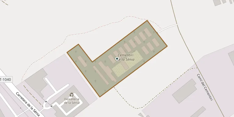
6,750 m²
cemetery area
Oct 18, 2026
last modified
About this cemetery
The municipal cemetery of La Sénia is listed in the Catalan architectural heritage inventory. It is catalogued as funerary art from the period 1911-1929. You can reach the cemetery on +34 977 71 30 00 or through invarquit.cultura.gencat.cat.
Cemetery location
GPS: GPS coordinates: 40.643663° N, 0.275941° E Directions in Google Maps (opens in a new tab)
Memorials
No records yet
Photograph a headstone and add it to the archive.
Looking for someone who isn't listed? Request a photo.
Nearby cemeteries
The closest other burial grounds listed on EveryStone.
- Rossell Cemetery 4.7 km away · Rosell
- Els Valentins Cemetery 7.1 km away · Els Valentins
- Sant Rafel del Riu Cemetery 7.9 km away · Sant Rafel del Maestrat
- Bel Cemetery 9.5 km away · Bel
- Canet lo Roig Municipal Cemetery 10.0 km away · Canet lo Roig
- La Pobla de Benifassà Municipal Cemetery 10 km away · La Pobla de Benifassà
- Fredes Cemetery 11 km away · Fredes
- Traiguera Municipal Cemetery 13 km away · Traiguera
- Mas de Barberans Cemetery 14 km away · Mas de Barberans
- La Jana Municipal Cemetery 15 km away · La Jana
Contribute with the app
Our website works smoothly on both desktop and mobile devices. Prefer a native app? Check it out below.
- Capture clear headstone photos
- Save GPS grave locations automatically
- Transcribe inscriptions with our AI
- Suggest corrections to existing records
Common questions
How big is La Sénia Municipal Cemetery?
La Sénia Municipal Cemetery covers about 6,750 m² (1.7 acres), about the size of a soccer field. It is the 153rd largest of the 628 cemeteries we list in Valencian Community.