
Cemetery #34985
Boves West Communal Cemetery Extension
Local name: Cimetière communal ouest de Boves, extension
0
documented records
≈ 15–31
approx. capacity (graves)
770 m²
cemetery area
Oct 18, 2026
last modified
About this cemetery
Boves West Communal Cemetery Extension was made in August 1918, and after the Armistice 32 graves were brought into it from the surrounding battlefields. The 49th Casualty Clearing Station was at Boves from 23 April to the end of August 1918, and Canadian clearing stations were also located there.
Cemetery location
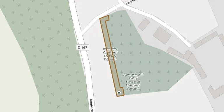
GPS coordinates: 49.844460° N, 2.379912° E Directions in Google Maps (opens in a new tab)
Memorials
No records yet
Photograph a headstone and add it to the archive.
Looking for someone who isn't listed? Request a photo.
Nearby cemeteries
The closest other burial grounds listed on EveryStone.
- Boves West Communal Cemetery 50 m away · Boves
- Boves East Communal Cemetery 1.1 km away · Boves
- Saint-Nicolas Cemetery 1.2 km away · Boves
- Fouencamps Cemetery 3.1 km away · Fouencamps
- Longueau British Cemetery 3.1 km away · Longueau
- Cagny Communal Cemetery 3.4 km away · Cagny
- Mémorial de Gentelles 3.4 km away · Amiens
- Longueau Communal Cemetery 3.8 km away · Longueau
- Cottenchy Cemetery 3.9 km away · Cottenchy
- Glisy Cemetery 3.9 km away · Lamotte-Brebière
Contribute with the app
Our website works smoothly on both desktop and mobile devices. Prefer a native app? Check it out below.
- Capture clear headstone photos
- Save GPS grave locations automatically
- Transcribe inscriptions with our AI
- Suggest corrections to existing records
Common questions
How big is Boves West Communal Cemetery Extension?
Boves West Communal Cemetery Extension covers about 770 m² (0.2 acres), about the size of 3 tennis courts. It is the 433rd smallest of the 4,957 cemeteries we list in Hauts-de-France.