
Cemetery #352018
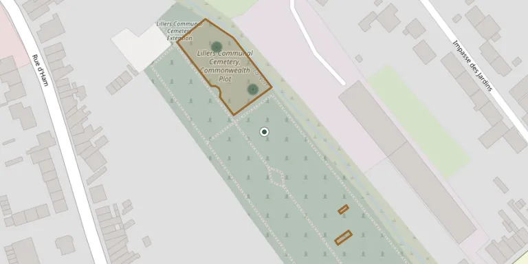
Lillers Communal Cemetery, Commonwealth Plot
Local name: Section britannique du cimetière communal de Lillers
2
documented records
≈ 35–69
approx. capacity (graves)
1,730 m²
cemetery area
Oct 18, 2026
last modified
About this cemetery
Lillers had Commonwealth headquarters offices and a hospital from autumn 1914 to April 1918, and casualties were buried in a part of the communal cemetery. After the German advance towards Robecq in April 1918, later burials were made in the extension at the back of the cemetery. The communal cemetery holds 894 Commonwealth burials of the First World War, 67 of them unidentified, plus 15 German graves. The cemetery can be found online through ww1cemeteries.com.
Cemetery location
GPS coordinates: 50.569080° N, 2.478121° E Directions in Google Maps (opens in a new tab)
Memorials
2 memorials, A–Z by surname.
Looking for someone who isn't listed? Request a photo.
Nearby cemeteries
The closest other burial grounds listed on EveryStone.
- Lillers Communal Cemetery Extension 50 m away · Lillers
- Lillers Old Cemetery 60 m away · Lillers
- Lillers New Cemetery 510 m away · Lillers
- Ecquedecques Cemetery 2.1 km away · Ecquedecques
- Ham-en-Artois Cemetery 2.9 km away · Ham-en-Artois
- Bourecq Churchyard 3.1 km away · Bourecq
- Busnes Communal Cemetery 3.4 km away · Busnes · 32 records
- Bourecq New Cemetery 3.5 km away · Bourecq
- Burbure Communal Cemetery 3.7 km away · Burbure
- Lespesses Cemetery 3.7 km away · Lespesses
Contribute with the app
Our website works smoothly on both desktop and mobile devices. Prefer a native app? Check it out below.
- Capture clear headstone photos
- Save GPS grave locations automatically
- Transcribe inscriptions with our AI
- Suggest corrections to existing records
Common questions
How big is Lillers Communal Cemetery, Commonwealth Plot?
Lillers Communal Cemetery, Commonwealth Plot covers about 1,730 m² (0.4 acres), about the size of 7 tennis courts. It is the 1,487th smallest of the 4,957 cemeteries we list in Hauts-de-France.
What is the oldest grave in this cemetery?
The oldest grave among the records we hold for Lillers Communal Cemetery, Commonwealth Plot is that of Kenneth MacDonald, who died on June 16, 1915 at the age of 22.