
Cemetery #352360
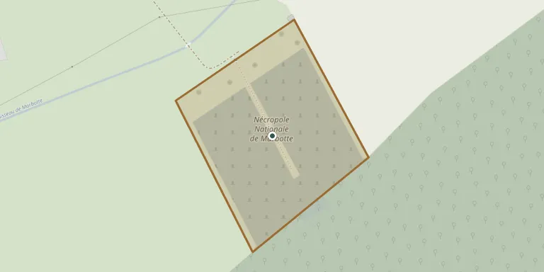
Marbotte National Cemetery
Local name: Nécropole Nationale de Marbotte
0
documented records
≈ 260–520
approx. capacity (graves)
0.013 km²
cemetery area
Oct 18, 2026
last modified
About this cemetery
The national necropolis of Marbotte, at Apremont-la-Forêt, was created in 1922 and reorganised in 1934 and 1936. It holds the remains of 2,656 soldiers, 2,652 of them French, who died in the fighting around the bois d'Ailly. A monument at the top honours the combatants of the 8th Army Corps. The cemetery's telephone number is +33 3 29 90 44 22, and you can find out more through monuments-aux-morts.fr.
Cemetery location
GPS: 48.833376° N, 5.587853° E Directions in Google Maps (opens in a new tab)
Memorials
No records yet
Photograph a headstone and add it to the archive.
Looking for someone who isn't listed? Request a photo.
Nearby cemeteries
The closest other burial grounds listed on EveryStone.
- Marbotte Cemetery 240 m away · Marbotte
- Saint-Julien-sous-les-Côtes Cemetery 2.6 km away · Saint-Julien-sous-les-Côtes
- Mécrin Cemetery 3.7 km away · Mécrin
- Boncourt-sur-Meuse Cemetery 3.8 km away · Le Grand Clos
- Han-sur-Meuse Cemetery 4.4 km away · Brasseitte
- Girauvoisin Cemetery 4.5 km away · Girauvoisin
- Apremont-la-Forêt Cemetery 4.6 km away · Apremont-la-Forêt
- Pont-sur-Meuse Cemetery 4.6 km away · Pont-sur-Meuse
- Saint-Mihiel German Military Cemetery 5.1 km away · Saint-Mihiel
- Lérouville Cemetery 5.7 km away · Lérouville
Contribute with the app
Our website works smoothly on both desktop and mobile devices. Prefer a native app? Check it out below.
- Capture clear headstone photos
- Save GPS grave locations automatically
- Transcribe inscriptions with our AI
- Suggest corrections to existing records
Common questions
How big is Marbotte National Cemetery?
Marbotte National Cemetery covers about 13,000 m² (3.2 acres), about the size of 2 soccer fields. It is the 257th largest of the 6,234 cemeteries we list in Grand Est.