
Cemetery #352501
Saint-Quentin National Cemetery
Local name: Nécropole nationale de Saint-Quentin
Also known as Cimetière Militaire National de Saint Quentin
0
documented records
≈ 320–640
approx. capacity (graves)
0.016 km²
cemetery area
Oct 18, 2026
last modified
About this cemetery
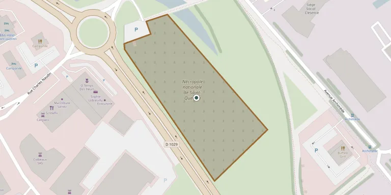
Saint-Quentin National Cemetery lies west of Saint-Quentin on the road to Amiens. It was created in 1923 and laid out in 1934 and 1935 by the French military authorities to regroup the graves of many small cemeteries. It holds soldiers who died in the fighting around the town, including the battles of August to November 1918. More about the cemetery can be found through ww1cemeteries.com.
Cemetery location
GPS: GPS coordinates: 49.854604° N, 3.263196° E Directions in Google Maps (opens in a new tab)
Memorials
No records yet
Photograph a headstone and add it to the archive.
Looking for someone who isn't listed? Request a photo.
Nearby cemeteries
The closest other burial grounds listed on EveryStone.
- Saint-Quentin German Military Cemetery 760 m away · Saint-Quentin
- La Tombelle Cemetery, Saint-Quentin 1.8 km away · Saint-Quentin
- Fayet Cemetery 2.0 km away · Fayet
- Saint-Jean Cemetery 2.1 km away · Saint-Quentin
- Francilly-Selency Cemetery 2.6 km away · Francilly-Selency
- Holnon Cemetery 3.6 km away · Holnon
- Gauchy Cemetery 3.7 km away · Gauchy
- Faubourg d'Isle South Cemetery 3.8 km away · Saint-Quentin
- Rouvroy Cemetery 4.1 km away · Rouvroy
- Gricourt Cemetery 4.2 km away · Fresnoy Le Petit
Contribute with the app
Our website works smoothly on both desktop and mobile devices. Prefer a native app? Check it out below.
- Capture clear headstone photos
- Save GPS grave locations automatically
- Transcribe inscriptions with our AI
- Suggest corrections to existing records
Common questions
How big is Saint-Quentin National Cemetery?
Saint-Quentin National Cemetery covers about 16,000 m² (3.9 acres), about the size of 2 soccer fields. It is the 307th largest of the 4,956 cemeteries we list in Hauts-de-France.