
Cemetery #35617
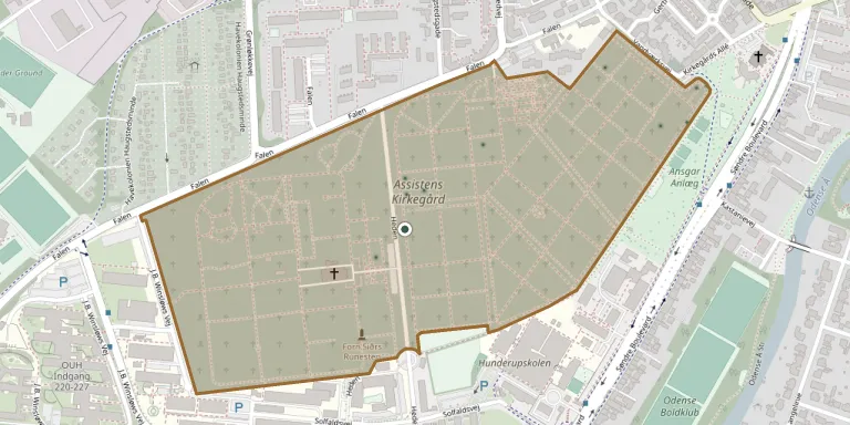
Assistens Churchyard
Local name: Assistens Kirkegård
Also known as Assistenskirkegård · Odense Cemetery · Odense Assistens Kirkegård
22
documented records
≈ 6k–12k
approx. capacity (graves)
0.301 km²
cemetery area
Oct 29, 2026
last modified
About this cemetery
Assistens Cemetery in Odense was founded in 1811 outside the town's Vesterport and laid out by royal garden inspector Hans von Müller. At 32 hectares it is the largest of the five municipal cemeteries in Odense and has been extended several times, most recently in 1947. One part of the cemetery holds 356 refugees and 263 German soldiers who died as victims of the Second World War.
Cemetery location
GPS: GPS coordinates: 55.388901° N, 10.369000° E Directions in Google Maps (opens in a new tab)
Memorials
22 memorials, A–Z by surname.
 Emanuel Allerup ? – 1895
- Jenny Allerup 1871 – 1925
- Johanne Allerup 1837 – 1928
- Ove Allerup 1866 – 1950
 Augusta Heltzen 1855 – 1887
 Agnete Henneby 1917 – 1968
- Aksel Henneby 1914 – 1972
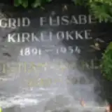 Sigrid Kirkelokke 1891 – 1954
- Christian Kirkeløkke 1889 – 1985
 Kaj Mork 1908 – 1997
 Else Poulsen 1895 – 1931
- Poul Poulsen 1861 – 1947
- Sophie Poulsen 1868 – 1933
 Jørgen Rasmussen 1841 – 1870
 Erik Schnakenburg 1892 – 1933
- Nielsen Weiersbye 1909 – 2006
- Norma Weiersbye 1920 – 2009
- Thomas Weiersbye 1905 – 1993
 Andreas Wibroe 1877 – 1954
- Elisabeth Wibroe 1887 – 1975
 Mogens Willrup 1918 – 1997
- Signe Wittrup 1914 – 2008
Looking for someone who isn't listed? Request a photo.
Nearby cemeteries
The closest other burial grounds listed on EveryStone.
- Commonwealth War Graves, Odense 130 m away · Odense
- Forn Siðrs Gravplads 170 m away · Odense
- Odense German War Cemetery 370 m away · Odense · 4 records
- Odense Jewish Cemetery 520 m away · Odense
- Dalum Churchyard 2.7 km away · Odense
- Fredens Cemetery 3.2 km away · Odense
- Korsløkke Churchyard 3.3 km away · Odense · 15 records
- Paarup Cemetery 3.9 km away · Odense
- Risings Churchyard 4.3 km away · Odense
- Stenløse Churchyard 5.4 km away · Sankt Klemens
Contribute with the app
Our website works smoothly on both desktop and mobile devices. Prefer a native app? Check it out below.
- Capture clear headstone photos
- Save GPS grave locations automatically
- Transcribe inscriptions with our AI
- Suggest corrections to existing records
Common questions
How big is Assistens Churchyard?
Assistens Churchyard covers about 30.1 hectares (301,000 m²), about the same size as Lychakiv Cemetery in Lviv. It is the 2nd largest of the 537 cemeteries we list in Region of Southern Denmark.
What is the oldest grave in this cemetery?
The oldest grave among the records we hold for Assistens Churchyard is that of Jørgen Rasmussen, who died on September 29, 1870 at the age of 29.