
3
documented records
≈ 390–790
approx. capacity (graves)
0.020 km²
cemetery area
Nov 5, 2026
last modified
About this cemetery
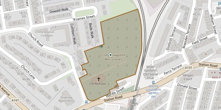
Commonwealth War Graves, Gosforth is a military or war cemetery in Tyne and Wear, United Kingdom.
Cemetery location
GPS coordinates: 55.007134° N, 1.608982° W Directions in Google Maps (opens in a new tab)
Memorials
3 memorials, A–Z by surname.
Looking for someone who isn't listed? Request a photo.
Nearby cemeteries
The closest other burial grounds listed on EveryStone.
- Gosforth (Saint Nicholas) Churchyard 80 m away · Gosforth
- Hollywood Avenue Cemetery 810 m away · Gosforth
- Ashburton Roman Catholic Cemetery 1.5 km away · Gosforth
- St. Andrew & Jesmond Cemetery 1.9 km away · Newcastle upon Tyne
- Byker and Heaton Cemetery 2.3 km away · Newcastle upon Tyne · 12 records
- All Saints Cemetery 2.6 km away · Newcastle upon Tyne
- Benton Cemetery 2.6 km away · Forest Hall
- Jesmond Old Cemetery 2.7 km away · Newcastle upon Tyne · 17 records
- Saint Nicholas Cemetery 3.7 km away · Newcastle upon Tyne · 1 record
- St Andrew Churchyard 3.8 km away · Newcastle upon Tyne
Contribute with the app
Our website works smoothly on both desktop and mobile devices. Prefer a native app? Check it out below.
- Capture clear headstone photos
- Save GPS grave locations automatically
- Transcribe inscriptions with our AI
- Suggest corrections to existing records
Common questions
How big is Commonwealth War Graves, Gosforth?
Commonwealth War Graves, Gosforth covers about 20,000 m² (4.9 acres), about the size of 3 soccer fields. It is the 40th largest of the 95 cemeteries we list in Tyne and Wear.
What is the oldest grave in this cemetery?
The oldest grave among the records we hold for Commonwealth War Graves, Gosforth is that of Phyllis Mary Beane, who died on May 16, 1929 at the age of 21.