
0
documented records
≈ 81–160
approx. capacity (graves)
4,040 m²
cemetery area
Oct 18, 2026
last modified
About this cemetery
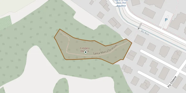
Founded in 1545 on the Cabalan hill, this cemetery was the burial place of Conegliano's Jewish community until the end of the nineteenth century and is no longer in use. It is entered today from Viale Gorizia and is known for its panoramic position. It is regarded as the last physical trace of the Jewish presence in the town.
Cemetery location
GPS: GPS coordinates: 45.888500° N, 12.285710° E Directions in Google Maps (opens in a new tab)
Memorials
No records yet
Photograph a headstone and add it to the archive.
Looking for someone who isn't listed? Request a photo.
Nearby cemeteries
The closest other burial grounds listed on EveryStone.
- Collalbrigo Cemetery 1.6 km away · Collalbrigo
- San Giuseppe Cemetery 2.1 km away · Conegliano
- Bagnolo Cemetery 2.5 km away · Bagnolo
- Sarano Cemetery 3.4 km away · Santa Lucia di Piave
- San Vendemiano Municipal Cemetery 3.5 km away · San Vendemiano
- Rua di Feletto Cemetery 3.6 km away · San Pietro di Feletto
- Santa Maria Cemetery 4.3 km away · Santa Maria
- Ogliano Cemetery 4.3 km away · Ogliano
- Susegana Cemetery 4.8 km away · Susegana · 14 records
- Ramera Cemetery 5.0 km away · Mareno di Piave
Contribute with the app
Our website works smoothly on both desktop and mobile devices. Prefer a native app? Check it out below.
- Capture clear headstone photos
- Save GPS grave locations automatically
- Transcribe inscriptions with our AI
- Suggest corrections to existing records
Common questions
How big is Conegliano Jewish Cemetery?
Conegliano Jewish Cemetery covers about 4,040 m² (1 acre), about half the size of a soccer field. It is the 591st largest of the 1,522 cemeteries we list in Veneto.