
Cemetery #408716
Kaunas French War Cemetery
Local name: Prancūzų karių kapinės
Also known as Šilainių prancūzų karių kapinės
0
documented records
≈ 150–310
approx. capacity (graves)
7,650 m²
cemetery area
Oct 18, 2026
last modified
About this cemetery
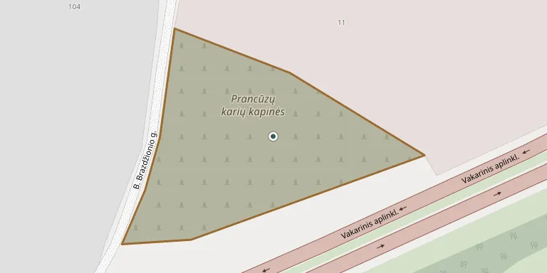
The French soldiers' cemetery lies in the former village of Šilainiai in Kaunas City Municipality and is recognised as a historical heritage site. Burial places of this kind, known in Lithuanian as prancūzkapiai, arose in 1812, when the defeated Grande Armée retreated through Lithuania during the French campaign.
Cemetery location
GPS coordinates: 54.929587° N, 23.857549° E Directions in Google Maps (opens in a new tab)
Memorials
No records yet
Photograph a headstone and add it to the archive.
Looking for someone who isn't listed? Request a photo.
Nearby cemeteries
The closest other burial grounds listed on EveryStone.
- Romainiai First Cemetery 760 m away · Kaunas
- Romainiai Cemetery No. 2 1.1 km away · Kaunas · 14 records
- Maironiškės Cemetery 1.5 km away · Kaunas · 8 records
- Veršvai Cemetery 1.8 km away · Veršvai
- Vilijampolė Old Jewish Cemetery 2.3 km away · Kaunas
- Žemieji Kaniūkai Cemetery 3.4 km away · Žemųjų Kaniūkai
- Leda Cemetery 3.5 km away · Leda
- Eiguliai Cemetery 4.0 km away · Kaunas · 104 records
- Žemaitkiemis Cemetery 4.4 km away · Kaunas
- Kaunas Lithuanian Partisans' Graves 4.6 km away · Kaunas
Contribute with the app
Our website works smoothly on both desktop and mobile devices. Prefer a native app? Check it out below.
- Capture clear headstone photos
- Save GPS grave locations automatically
- Transcribe inscriptions with our AI
- Suggest corrections to existing records
Common questions
How big is Kaunas French War Cemetery?
Kaunas French War Cemetery covers about 7,650 m² (1.9 acres), about the size of a soccer field. It is the 116th largest of the 355 cemeteries we list in Kaunas County.