
Cemetery #414695
San Joaquín French Cemetery, Miguel Hidalgo
Local name: Panteón Francés de San Joaquín
0
documented records
≈ 5k–10k
approx. capacity (graves)
0.250 km²
cemetery area
Oct 18, 2026
last modified
About this cemetery
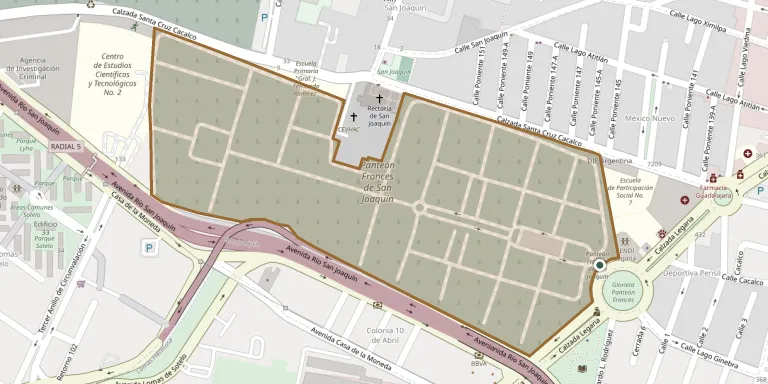
The Panteón Francés de San Joaquín, also known as the Panteón Francés de Legaria, is a private cemetery in Mexico City. It was built in 1940 and founded in 1942, after the older Panteón Francés de la Piedad stopped selling plots. Entry is restricted to relatives of those buried there, and the cemetery holds a number of Mexican and foreign personalities.
Cemetery location
GPS: GPS coordinates: 19.449640° N, 99.204750° W Directions in Google Maps (opens in a new tab)
Memorials
No records yet
Photograph a headstone and add it to the archive.
Looking for someone who isn't listed? Request a photo.
Nearby cemeteries
The closest other burial grounds listed on EveryStone.
- Miguel Hidalgo American Cemetery 1.0 km away · Miguel Hidalgo
- Sanctorum Cemetery 1.0 km away · Miguel Hidalgo
- Tacuba German Cemetery 1.1 km away · México
- Britanico Cemetery 1.3 km away · Miguel Hidalgo
- Monte Sinaí Cemetery 1.4 km away · Miguel Hidalgo
- Mexico City Spanish Cemetery 1.5 km away · Mexico
- Santa Cruz Acayucan Cemetery 3.0 km away · Ciudad de México
- Santa Lucía Cemetery 3.1 km away · Azcapotzalco
- San Andrés Atoto Municipal Cemetery 3.3 km away · Naucalpan de Juárez
- Mexico City National Cemetery 4.1 km away · Cuauhtémoc
Contribute with the app
Our website works smoothly on both desktop and mobile devices. Prefer a native app? Check it out below.
- Capture clear headstone photos
- Save GPS grave locations automatically
- Transcribe inscriptions with our AI
- Suggest corrections to existing records
Common questions
How big is San Joaquín French Cemetery, Miguel Hidalgo?
San Joaquín French Cemetery, Miguel Hidalgo covers about 25 hectares (250,000 m²), about the same size as Powązki Military Cemetery in Warsaw. It is the 6th largest of the 74 cemeteries we list in Mexico City.