
0
documented records
≈ 210–420
approx. capacity (graves)
0.011 km²
cemetery area
Oct 18, 2026
last modified
About this cemetery
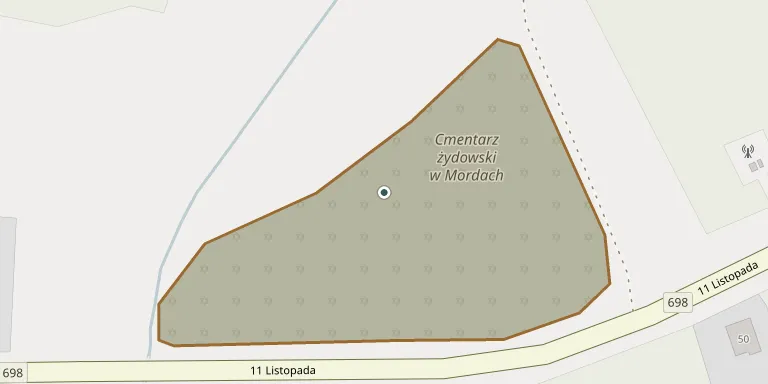
The cemetery on 11 Listopada Street, about 700 metres from the centre of Mordy, was founded in the 19th century. Locals call it 'kierkut' and 'mogiłki'. It originally covered 1 hectare, and several dozen mostly damaged gravestones survive. It lies in a wooded area on the town's eastern edge and is fenced with mesh.
Cemetery location
GPS: 52.211823° N, 22.528314° E Directions in Google Maps (opens in a new tab)
Memorials
No records yet
Photograph a headstone and add it to the archive.
Looking for someone who isn't listed? Request a photo.
Nearby cemeteries
The closest other burial grounds listed on EveryStone.
- Mordy Cemetery 1.3 km away · Mordy
- Czołomyje Parish Cemetery 4.6 km away · Czołomyje
- Bejdy Parish Cemetery 6.6 km away · Bejdy
- Krzymosze Cemetery 6.7 km away · Wielgorz · 120 records
- Przesmyki Roman Catholic Cemetery 7.4 km away · Przesmyki
- Radzików Parish Cemetery 8.2 km away · Radzików
- Pruszyn Cemetery 8.7 km away · Pruszyn · 469 records
- Hołubla Roman Catholic Cemetery 11 km away · Hołubla
- Hadynów Parish Cemetery 11 km away · Hadynów · 80 records
- Paprotnia Roman Catholic Cemetery 11 km away · Paprotnia
Contribute with the app
Our website works smoothly on both desktop and mobile devices. Prefer a native app? Check it out below.
- Capture clear headstone photos
- Save GPS grave locations automatically
- Transcribe inscriptions with our AI
- Suggest corrections to existing records
Common questions
How big is Mordy Jewish Cemetery?
Mordy Jewish Cemetery covers about 11,000 m² (2.6 acres), about the size of a soccer field. It is the 601st smallest of the 1,221 cemeteries we list in Masovian Voivodeship.