
Cemetery #4312
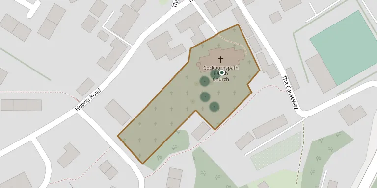
Cockburnspath Parish Church
Also known as Churchyard, Cockburnspath Parish Church
15
documented records
≈ 75–150
approx. capacity (graves)
3,760 m²
cemetery area
Nov 5, 2026
last modified
About this cemetery
The churchyard surrounds the medieval parish church of Cockburnspath in the Scottish Borders. The church was rebuilt on the original site in the 14th and 15th centuries, and the churchyard is a Category A listed building. The parish registers date from 1642.
Cemetery location
GPS: 55.931900° N, 2.362500° W Directions in Google Maps (opens in a new tab)
Memorials
15 memorials, A–Z by last name.
 Jeanie Fairbairn 1869 – 1872
- John Fairbairn ? – 1872
- William Fairbairn ? – 1893
- Margaret Grant ? – 1896
 Isabella Hardie ? – 1922
- Richard Hardie ? – 1913
 Eliza Mack ? – 1894
- Jane Mack ? – 1924
- Jane Mack ? – 1848
- Jessie Mack 1853 – 1932
- Joseph Mack ? – 1835
- Margaret Mack ? – 1872
- Thomas Mack ? – 1869
 Mary Paxton 1886 – 1957
- Isabella Watt 1830 – 1912
Looking for someone who isn't listed? Request a photo.
Nearby cemeteries
The closest other burial grounds listed on EveryStone.
- Cockburnspath Cemetery 580 m away · Cove
- Oldhamstocks Parish Churchyard 3.6 km away · Oldhamstocks
- Renton House Burial Ground 7.8 km away · Renton Barns
- Abbey St. Bathans Parish Churchyard 8.9 km away · Abbey Saint Bathans
- Houndwood Churchyard 10.0 km away · Houndwood · 12 records
- Dunbar Cemetery 11 km away · Broxburn
- Spott Parish Churchyard 11 km away · Spott
- Dunbar Parish Church Cemetery 12 km away · Dunbar · 28 records
- Bonkyl Parish Church 12 km away · Preston · 6 records
- Cranshaws Church 12 km away · Longformacus · 7 records
Contribute with the app
Our website works smoothly on both desktop and mobile devices. Prefer a native app? Check it out below.
- Capture clear headstone photos
- Save GPS grave locations automatically
- Transcribe inscriptions with our AI
- Suggest corrections to existing records
Common questions
How big is Cockburnspath Parish Church?
Cockburnspath Parish Church covers about 3,760 m² (0.9 acres), about half the size of a soccer field. It is the 65th smallest of the 146 cemeteries we list in Scottish Borders.
What is the oldest grave in this cemetery?
The oldest grave among the records we hold for Cockburnspath Parish Church is that of Joseph Mack, who died on April 24, 1835.