
Cemetery #45788
Wołomin Cemetery
Local name: Wołomin, cmentarz
Also known as Cmentarz w Wołominie · Grób Nieznanego Żołnierza w Leśniakowiznie · Mogiła Powstańczych Oddziałów Specjalnych Jerzyki w Leśniakowiznie · Cmentarz grzebalny parafii rzymskokatolickiej pw. Matki Boskiej Częstochowskiej
0
documented records
≈ 1,900–3,800
approx. capacity (graves)
0.095 km²
cemetery area
Oct 18, 2026
last modified
About this cemetery
The parish cemetery in Wołomin belongs to the parish of Our Lady of Częstochowa and is an active Roman Catholic cemetery. Its history dates back to the 19th century.
Cemetery location
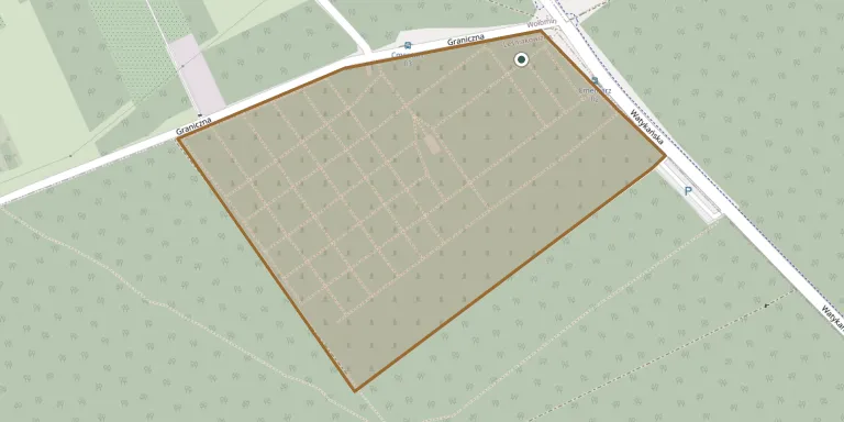
GPS coordinates: 52.331800° N, 21.273557° E Directions in Google Maps (opens in a new tab)
Memorials
No records yet
Photograph a headstone and add it to the archive.
Looking for someone who isn't listed? Request a photo.
Nearby cemeteries
The closest other burial grounds listed on EveryStone.
- Leśniakowizna Home Army Soldiers' Mass Grave 100 m away · Wołomin
- Mostówka Former Evangelical Cemetery 2.2 km away · Mostówka
- Ossów Cemetery of the Fallen in the Battle of Warsaw 1920 4.6 km away · Ossów
- Duczki Parish Cemetery 4.7 km away · Duczki
- Kobyłka Old Parish Cemetery 4.7 km away · Kobyłka · 1 record
- Wołomin Roman Catholic Cemetery 4.9 km away · Wołomin
- Helenów Roman Catholic Cemetery 5.3 km away · Helenów
- Kobyłka New Parish Cemetery 5.4 km away · Kobyłka
- Zabraniec Parish Cemetery 5.5 km away · Zabraniec
- Okuniew Roman Catholic Cemetery 7.4 km away · Okuniew
Contribute with the app
Our website works smoothly on both desktop and mobile devices. Prefer a native app? Check it out below.
- Capture clear headstone photos
- Save GPS grave locations automatically
- Transcribe inscriptions with our AI
- Suggest corrections to existing records
Common questions
How big is Wołomin Cemetery?
Wołomin Cemetery covers about 95,000 m² (23 acres), about the size of 13 soccer fields. It is the 26th largest of the 1,222 cemeteries we list in Masovian Voivodeship.