
0
documented records
≈ 570–1,100
approx. capacity (graves)
0.029 km²
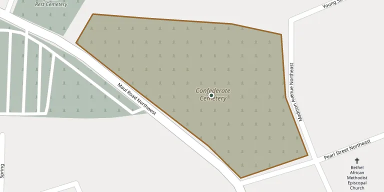
cemetery area · 7.07 acres
Oct 18, 2026
last modified
About this cemetery
Oakland Cemetery in Camden, Arkansas, also known as Confederate Cemetery, is on Maul Road and was the city's first cemetery. It dates from 1830, well before the Civil War, and includes a Confederate section. The body of an unknown girl who died on a flatboat on the Ouachita River is said to have been buried there before 1840. It was listed on the National Register of Historic Places in 2000.
Cemetery location
GPS: GPS coordinates: 33.593300° N, 92.833100° W Directions in Google Maps (opens in a new tab)
Memorials
No records yet
Photograph a headstone and add it to the archive.
Looking for someone who isn't listed? Request a photo.
Nearby cemeteries
The closest other burial grounds listed on EveryStone.
- Confederate Cemetery, Camden 20 m away · Camden
- Jewish Rest Cemetery 200 m away · Camden
- Greenwood Cemetery 230 m away · Camden
- Memorial Park Cemetery, Camden 610 m away · Camden
- Hawkins Cemetery 6.4 km away · Lester Junction
- Pleasant Hill Cemetery 8.5 km away · Fairview
- Mount Olive Cemetery 8.6 km away · Fairview
- Lakeside Cemetery 8.9 km away · Lakeside
- Eternal Rest Cemetery 8.9 km away · Lester Junction
- Martin Cemetery 9.8 km away · Harmony Grove
Contribute with the app
Our website works smoothly on both desktop and mobile devices. Prefer a native app? Check it out below.
- Capture clear headstone photos
- Save GPS grave locations automatically
- Transcribe inscriptions with our AI
- Suggest corrections to existing records
Common questions
How big is Oakland Cemetery?
Oakland Cemetery covers about 29,000 m² (7.1 acres), about the size of 5 American football fields. It is the 298th largest of the 3,521 cemeteries we list in Arkansas.