
Cemetery #562545
Quinette Cemetery
0
documented records
≈ 140–280
approx. capacity (graves)
7,110 m²
cemetery area · 1.76 acres
Oct 18, 2026
last modified
About this cemetery
Quinette Cemetery in Kirkwood, Missouri, was established in 1866 on land donated by Moses and Nancy Quinette and was originally associated with the Olive Chapel African Methodist Episcopal Church. It has 25 marked graves, though some 150 to 200 people are believed to be buried there, and the earliest known grave dates to 1853. Those interred include African-American Civil War soldiers and formerly enslaved people. The cemetery was deeded to the city of Kirkwood in 2002.
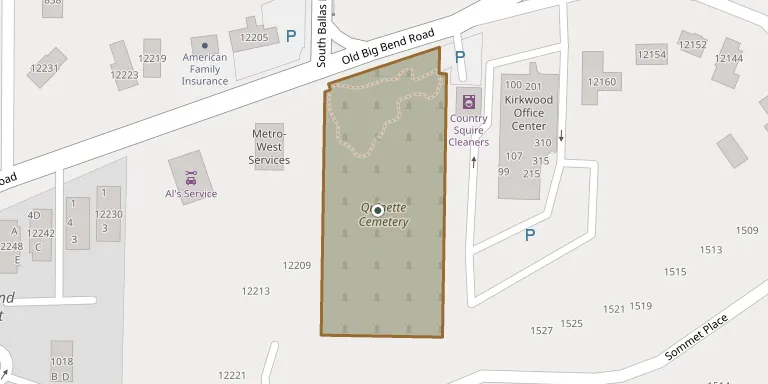
Cemetery location
GPS coordinates: 38.568500° N, 90.434600° W Directions in Google Maps (opens in a new tab)
Memorials
No records yet
Photograph a headstone and add it to the archive.
Looking for someone who isn't listed? Request a photo.
Nearby cemeteries
The closest other burial grounds listed on EveryStone.
- Saint Peter Cemetery 1.9 km away · Kirkwood
- Oak Hill Cemetery 3.3 km away · Kirkwood
- Saint Paul's Lutheran Cemetery 3.6 km away · St. Louis
- Smith Sturdy Cemetery 4.1 km away · Crestwood
- Father Dickson Cemetery 4.3 km away · Crestwood
- Eddy Cemetery 4.8 km away · Crestwood
- Rock Hill Cemetery 5.3 km away · Sappington
- Saint Lucas Cemetery 5.3 km away · Sunset Hills
- Valley Park City Cemetery 5.8 km away · Valley Park
- Saint Paul Cemetery 6.5 km away · Fenton
Contribute with the app
Our website works smoothly on both desktop and mobile devices. Prefer a native app? Check it out below.
- Capture clear headstone photos
- Save GPS grave locations automatically
- Transcribe inscriptions with our AI
- Suggest corrections to existing records
Common questions
How big is Quinette Cemetery?
Quinette Cemetery covers about 7,110 m² (1.8 acres), about the size of an American football field. It is the 2,052nd largest of the 5,368 cemeteries we list in Missouri.