
Cemetery #6869
Browns Road Military Cemetery
Local name: Cimetière militaire de Brown's Road
0
documented records
≈ 75–150
approx. capacity (graves)
3,750 m²
cemetery area
Oct 18, 2026
last modified
About this cemetery
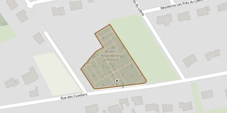
Browns Road Military Cemetery lies near Festubert, about 6 kilometres east of Béthune. It was opened in October 1914 and used by fighting and medical units until November 1917. The cemetery now contains 1,071 burials and commemorations of the First World War, of which 407 burials are unidentified.
Cemetery location
GPS: GPS coordinates: 50.540512° N, 2.733141° E Directions in Google Maps (opens in a new tab)
Memorials
No records yet
Photograph a headstone and add it to the archive.
Looking for someone who isn't listed? Request a photo.
Nearby cemeteries
The closest other burial grounds listed on EveryStone.
- Festubert Communal Cemetery 370 m away · Festubert
- Post Office Rifles Cemetery 610 m away · Festubert
- Guards Cemetery Windy Corner 1.4 km away · Cuinchy
- Le Touret Military Cemetery 2.3 km away · Richebourg-l'Avoué · 1 record
- Gorre British And Indian Cemetery 2.4 km away · Gorre
- Givenchy-lès-la-Bassée Communal Cemetery 2.5 km away · Givenchy-lès-la-Bassée
- Woburn Abbey Cemetery 2.9 km away · Cuinchy
- Cuinchy Communal Cemetery 3.1 km away · Cuinchy
- Cambrin Military Cemetery 3.1 km away · Cambrin
- Cambrin Cemetery 3.4 km away · Cambrin
Contribute with the app
Our website works smoothly on both desktop and mobile devices. Prefer a native app? Check it out below.
- Capture clear headstone photos
- Save GPS grave locations automatically
- Transcribe inscriptions with our AI
- Suggest corrections to existing records
Common questions
How big is Browns Road Military Cemetery?
Browns Road Military Cemetery covers about 3,750 m² (0.9 acres), about half the size of a soccer field. It is the 1,713th largest of the 4,956 cemeteries we list in Hauts-de-France.