
0
documented records
≈ 800–1,600
approx. capacity (graves)
0.040 km²
cemetery area
Oct 18, 2026
last modified
About this cemetery
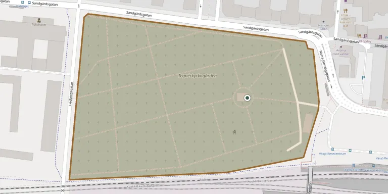
Tegnérkyrkogården lies in the centre of Växjö, about 500 metres west of the cathedral. It was laid out in 1807 to drawings by Fredrik Magnus Piper. The adjoining Tegnér chapel is named after Bishop Esaias Tegnér and was approved by the parish meeting in 1850. To get in touch, call +46 470 70 49 00 or visit svenskakyrkan.se.
Cemetery location
GPS coordinates: 56.877434° N, 14.802146° E Directions in Google Maps (opens in a new tab)
Memorials
No records yet
Photograph a headstone and add it to the archive.
Looking for someone who isn't listed? Request a photo.
Nearby cemeteries
The closest other burial grounds listed on EveryStone.
- Skogslyckans Churchyard 1.4 km away · Växjö
- Torparängen Cemetery 2.8 km away · Växjö
- Hovshaga Churchyard 3.4 km away · Växjö
- Bergunda Churchyard 3.9 km away · Växjö
- Öjaby Churchyard 4.9 km away · Öjaby
- Hemmesjö Churchyard 8.7 km away · Växjö
- Hemmesjö Churchyard 11 km away · Åryd
- Vederslöv Churchyard 11 km away · Vederslöv
- Tävelsås Churchyard 11 km away · Tävelsås
- Öja Churchyard 12 km away · Växjö
Contribute with the app
Our website works smoothly on both desktop and mobile devices. Prefer a native app? Check it out below.
- Capture clear headstone photos
- Save GPS grave locations automatically
- Transcribe inscriptions with our AI
- Suggest corrections to existing records
Common questions
How big is Tegnér Cemetery, Växjö?
Tegnér Cemetery, Växjö covers about 40,000 m² (9.9 acres), about the size of 6 soccer fields. It is the 6th largest of the 93 cemeteries we list in Kronoberg.