
0
documented records
≈ 760–1,500
approx. capacity (graves)
0.038 km²
cemetery area
Oct 18, 2026
last modified
About this cemetery
The cemetery of Perchtoldsdorf was first located around the parish church and was moved around 1586 to 1587 into the courtyard of Perchtoldsdorf Castle because of lack of space. The Protestant residents were given a burial ground in the so-called Metzgergarten next to the castle. The present cemetery, owned by the municipality, opened on 1 November 1877, and the older one was closed in 1883. It has been enlarged several times and has honorary graves. For enquiries, call +43 1 86683140 or see perchtoldsdorf.at.
Cemetery location
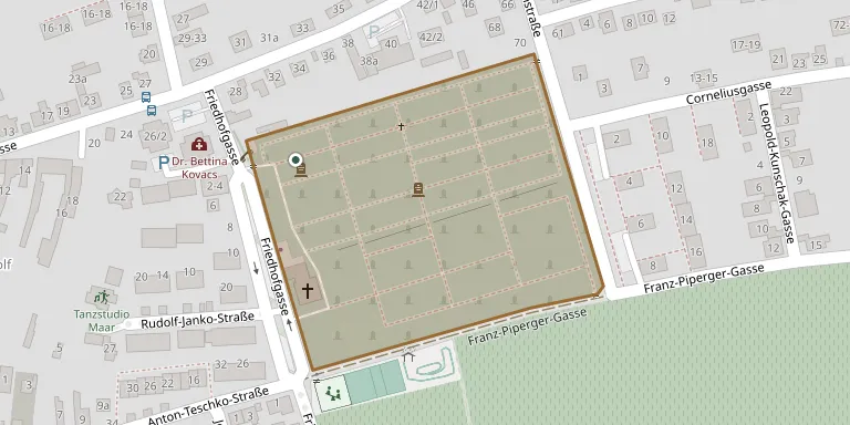
GPS coordinates: 48.117687° N, 16.274562° E Directions in Google Maps (opens in a new tab)
Memorials
No records yet
Photograph a headstone and add it to the archive.
Looking for someone who isn't listed? Request a photo.
Nearby cemeteries
The closest other burial grounds listed on EveryStone.
- Brunn am Gebirge Cemetery 1.7 km away · Brunn am Gebirge
- Rodaun Cemetery 1.9 km away · Liesing
- Liesing Cemetery 2.1 km away · Vienna
- Maria Enzersdorf Cemetery (Romantics' Cemetery) 2.7 km away · Maria Enzersdorf
- Kalksburg Cemetery 2.8 km away · Vienna
- Siebenhirten Cemetery 2.9 km away · Vienna
- Grießhübl Cemetery 3.0 km away · Gießhübl · 2 records
- St. Gabriel Mission House Cemetery, Maria Enzersdorf 3.0 km away · Maria Enzersdorf
- Atzgersdorf Cemetery 3.3 km away · Vienna
- Erlaa Cemetery 4.0 km away · Vienna
Contribute with the app
Our website works smoothly on both desktop and mobile devices. Prefer a native app? Check it out below.
- Capture clear headstone photos
- Save GPS grave locations automatically
- Transcribe inscriptions with our AI
- Suggest corrections to existing records
Common questions
How big is Perchtoldsdorf Cemetery?
Perchtoldsdorf Cemetery covers about 38,000 m² (9.3 acres), about the size of 5 soccer fields. It is the 15th largest of the 1,114 cemeteries we list in Lower Austria.