
30
documented records
≈ 240–480
approx. capacity (graves)
0.012 km²
cemetery area
Nov 5, 2026
last modified
About this cemetery
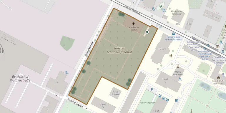
The Inner Matthäusfriedhof in Dresden's Friedrichstadt district was laid out in 1724, and the associated church was built in the following years. It is an Evangelical cemetery close to the Matthäuskirche, which was completely destroyed in the bombing of Dresden on 13 February 1945. It is administered by the Annen-Matthäus parish.
Cemetery location
GPS coordinates: 51.060246° N, 13.716356° E Directions in Google Maps (opens in a new tab)
Memorials
30 memorials, A–Z by surname.
 Alfred Bochmann 1905 – 1986
- Bertha Bochmann 1881 – 1945
- Dora Bochmann 1903 – 1987
- Max Bochmann 1874 – 1956
 Else Bretschneider 1912 – 1958
- Erich Bretschneider 1914 – 1988
- Kurt Bretschneider 1882 – 1946
- Margarethe Bretschneider 1884 – 1955
 Heinrich Hornickel 1822 – 1909
- Christian Jaenicke 1841 – 1908
- Marie Jaenicke 1854 – 1936
 Emma Kottig 1883 – 1967
- Otto Kottig 1878 – 1952
- Anneliese Müller 1914 – 1990
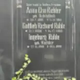 Anna Richter 1886 – 1961
- Gottlieb Rühle 1900 – 1969
- Ingeborg Rühle 1919 – 1991
- Anna Schädlich 1862 – 1921
 Carl Sowoidnich 1846 – 1911
- Marie Sowoidnich 1852 – 1928
 Helene Streubel 1877 – 1961
- Paul Streubel 1877 – 1957
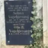 Otto Vogelgesang 1865 – 1925
- Selma Vogelgesang 1865 – 1921
- Johanna Weber 1909 – 1945
- Lutz Weber 1940 – 1945
- Gunter Weissflog 1909 – 1970
- Meta Weissflog 1883 – 1954
- Richard Weissflog 1881 – 1944
- Harry Zöllner 1897 – 1918
Looking for someone who isn't listed? Request a photo.
Nearby cemeteries
The closest other burial grounds listed on EveryStone.
- Friedrichstadt Old Catholic Cemetery 180 m away · Dresden · 28 records
- St. Matthew Former Outer Cemetery, Dresden 840 m away · Dresden
- Friedrichstadt New Catholic Cemetery 1.1 km away · Dresden · 11 records
- Dresden Inner New Town Cemetery 2.3 km away · Dresden
- Annen New Cemetery, Dresden 2.4 km away · Dresden
- Old St. Anne Cemetery, Dresden 2.7 km away · Dresden
- St. Mark Cemetery, Mickten 2.9 km away · Mickten
- Elias Cemetery, Dresden 2.9 km away · Dresden
- Dresden Old Jewish Cemetery 3.0 km away · Dresden
- Briesnitz Inner Cemetery 3.2 km away · Dresden · 13 records
Contribute with the app
Our website works smoothly on both desktop and mobile devices. Prefer a native app? Check it out below.
- Capture clear headstone photos
- Save GPS grave locations automatically
- Transcribe inscriptions with our AI
- Suggest corrections to existing records
Common questions
How big is St. Matthew Inner Cemetery, Dresden?
St. Matthew Inner Cemetery, Dresden covers about 12,000 m² (3 acres), about the size of 2 soccer fields. It is the 285th largest of the 1,500 cemeteries we list in Saxony.
What is the oldest grave in this cemetery?
The oldest grave among the records we hold for St. Matthew Inner Cemetery, Dresden is that of Christian Rudolph Jaenicke, who died on April 17, 1908 at the age of 67.