
Cemetery #816269
Solidaridad Cemetery
Local name: Panteón Solidaridad
0
documented records
≈ 670–1,300
approx. capacity (graves)
0.034 km²
cemetery area
Oct 8, 2026
last modified
About this cemetery
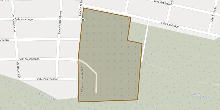
Solidaridad Cemetery lies in Ampliación San Mateo, State of Mexico, Mexico. Questions about the cemetery can be put by phone on +52 55 5867 1769.
Cemetery location
GPS coordinates: 19.607615° N, 99.144630° W Directions in Google Maps (opens in a new tab)
Memorials
No records yet
Photograph a headstone and add it to the archive.
Looking for someone who isn't listed? Request a photo.
Nearby cemeteries
The closest other burial grounds listed on EveryStone.
- Santa María Cuautepec Local Cemetery 2.6 km away · Fuentes del Valle
- Buenavista Municipal Cemetery 3.0 km away · Buenavista
- El Tesoro Cemetery 3.5 km away · Buenavista
- San Martín Tepetlixpan Village Cemetery 5.5 km away · Cuautitlán Izcalli
- Horizonte de Paz Ecological Cemetery 5.7 km away · Tlalnepantla
- Loma Bonita Municipal Cemetery 5.8 km away · Cuautitlán
- Santa María Guadalupe Community Cemetery 5.9 km away · Cuautitlán Izcalli
- Cuautepec Cemetery 6.3 km away · Gustavo A. Madero
- Jardines del Recuerdo Cemetery, Tlalnepantla de Baz 6.6 km away · Tlalnepantla de Baz
- San Lorenzo Tetlixtac Community Cemetery 6.7 km away · Hacienda de Teruel
Contribute with the app
Our website works smoothly on both desktop and mobile devices. Prefer a native app? Check it out below.
- Capture clear headstone photos
- Save GPS grave locations automatically
- Transcribe inscriptions with our AI
- Suggest corrections to existing records
Common questions
How big is Solidaridad Cemetery?
Solidaridad Cemetery covers about 34,000 m² (8.3 acres), about the size of 5 soccer fields. It is the 30th largest of the 371 cemeteries we list in State of Mexico.