
Chubut
24 known cemeteries in Chubut, Argentina.
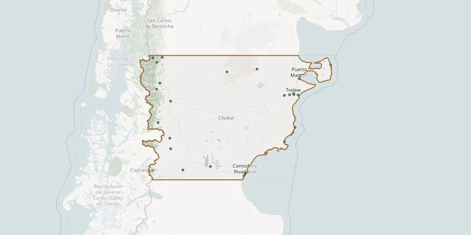 © OpenStreetMap
- Alto Río Senguer Local CemeteryGPS coordinates: 45.02094° S, 70.80464° W
- Apeleg Village CemeteryGPS coordinates: 44.68252° S, 70.84073° W
- Cabo Raso CemeteryGPS coordinates: 44.33811° S, 65.23830° W
- Camarones Municipal CemeteryGPS coordinates: 44.79602° S, 65.70767° W
- Dolavon CemeteryGPS coordinates: 43.30328° S, 65.71008° W
- El Maitén CemeteryGPS coordinates: 42.05136° S, 71.17593° W
- Gaiman Cemetery (Mynwent y Gaiman)GPS coordinates: 43.28501° S, 65.48084° W
- Gan Gan CemeteryGPS coordinates: 42.52962° S, 68.28457° W
- Garden El Parque CemeteryGPS coordinates: 42.90445° S, 71.29002° W
- Km 5 CemeteryGPS coordinates: 45.80943° S, 67.46483° W
- Km 9 El Empalme CemeteryGPS coordinates: 45.79151° S, 67.45230° W
- Lago Epuyén CemeteryGPS coordinates: 42.21563° S, 71.42931° W
- Lago Puelo Municipal CemeteryGPS coordinates: 42.06611° S, 71.59542° W
- Moriah Chapel Cemetery, TrelewGPS coordinates: 43.27550° S, 65.28200° W
- Oeste CemeteryGPS coordinates: 45.86840° S, 67.51200° W
- Puerto Madryn CemeteryGPS coordinates: 42.75050° S, 65.04092° W
- Rawson Municipal CemeteryGPS coordinates: 43.29414° S, 65.09716° W
- Río Mayo CemeteryGPS coordinates: 45.69142° S, 70.25072° W
- Río Pico CemeteryGPS coordinates: 44.18560° S, 71.36637° W
- Sarmiento Municipal CemeteryGPS coordinates: 45.58554° S, 69.02278° W
- Tecka CemeteryGPS coordinates: 43.49140° S, 70.80490° W
- Telsen CemeteryGPS coordinates: 42.43852° S, 66.93872° W
- Trelew Municipal CemeteryGPS coordinates: 43.24290° S, 65.29726° W
- Trevelin CemeteryGPS coordinates: 43.10293° S, 71.42957° W