
Misiones
81 known cemeteries in Misiones, Argentina.
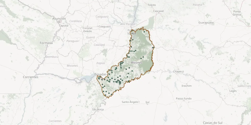 © OpenStreetMap
- Garuhapé CemeteryGPS coordinates: 26.82845° S, 54.95540° W
- Garupa CemeteryGPS coordinates: 27.47492° S, 55.83322° W
- General Alvear Cemetery near OberáGPS coordinates: 27.39156° S, 55.16690° W
- Guaraní Cemetery near Picada SuecaGPS coordinates: 27.53792° S, 55.19710° W
- Itacaruaré CemeteryGPS coordinates: 27.88602° S, 55.24914° W
- Ita Curuzu CemeteryGPS coordinates: 26.62744° S, 54.68984° W
- Jardín América New Cemetery (Jardín de Paz)GPS coordinates: 27.06203° S, 55.22655° W
- Jardín de Paz Municipal Cemetery, Jardín AméricaGPS coordinates: 27.02955° S, 55.23311° W
- José de Arimatea CemeteryGPS coordinates: 27.08921° S, 55.26842° W
- La Paz CemeteryGPS coordinates: 27.56107° S, 55.06079° W
- La Piedad Municipal CemeteryGPS coordinates: 26.40105° S, 54.65372° W
- La Piedad Municipal Cemetery, OberáGPS coordinates: 27.51648° S, 55.11783° W
- La Piedad Municipal Cemetery, PosadasGPS coordinates: 27.38058° S, 55.91289° W
- Las Tunas CemeteryGPS coordinates: 27.91975° S, 55.65638° W
- Lázaro CemeteryGPS coordinates: 27.55618° S, 55.10312° W
- Los Helechos Seventh-day Adventist CemeteryGPS coordinates: 27.58524° S, 55.10384° W
- Mbopicuá CemeteryGPS coordinates: 26.85734° S, 55.04837° W
- Montecarlo CemeteryGPS coordinates: 26.56434° S, 54.78535° W
- Naria auxiliadora CemeteryGPS coordinates: 27.72161° S, 55.72160° W
- Oberá Martyrs' CemeteryGPS coordinates: 27.42762° S, 55.41043° W
- Oberá Swedish CemeteryGPS coordinates: 27.49385° S, 55.16044° W
- Olegario Víctor Andrade CemeteryGPS coordinates: 27.55774° S, 55.51147° W
- Paraguayan Cemetery near ApóstolesGPS coordinates: 27.65425° S, 55.81565° W
- Paraíso CemeteryGPS coordinates: 26.68067° S, 54.19276° W
- Paraje Primavera CemeteryGPS coordinates: 27.24407° S, 54.73036° W
- Picada Sueca CemeteryGPS coordinates: 27.55523° S, 55.24880° W
- Posadas Police CemeteryGPS coordinates: 27.38146° S, 55.91291° W
- Posadas Ukrainian CemeteryGPS coordinates: 27.43936° S, 55.94997° W
- Pueblo Illia CemeteryGPS coordinates: 27.15028° S, 54.56673° W
- Puerto Esperanza Communal CemeteryGPS coordinates: 26.01370° S, 54.62900° W