
Neuquén
22 known cemeteries in Neuquén, Argentina.
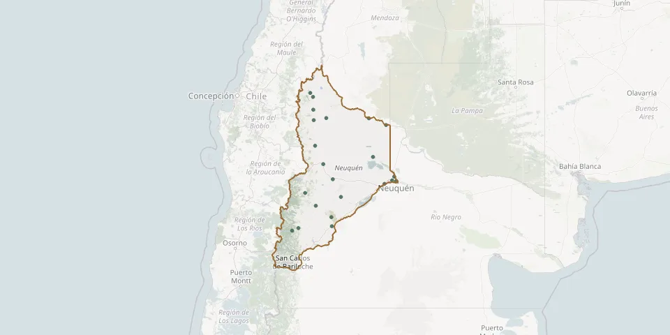 © OpenStreetMap
- Aluminé Municipal CemeteryGPS coordinates: 39.23750° S, 70.92806° W
- Andacollo Municipal CemeteryGPS coordinates: 37.17751° S, 70.67269° W
- Añelo CemeteryGPS coordinates: 38.35126° S, 68.78802° W
- Centenario CemeteryGPS coordinates: 38.83984° S, 68.12307° W
- Chos Malal Municipal CemeteryGPS coordinates: 37.38494° S, 70.26308° W
- Cinco Saltos Central CemeteryGPS coordinates: 38.94832° S, 68.05422° W
- El Cholar CemeteryGPS coordinates: 37.43928° S, 70.65562° W
- Las Coloradas CemeteryGPS coordinates: 39.55192° S, 70.58889° W
- Las Lajas CemeteryGPS coordinates: 38.52924° S, 70.35554° W
- Loncopué Municipal CemeteryGPS coordinates: 38.07514° S, 70.61071° W
- Manzano Amargo Municipal CemeteryGPS coordinates: 36.75941° S, 70.76502° W
- Paso Aguerre CemeteryGPS coordinates: 39.33682° S, 69.80252° W
- Piedra del Águila Municipal CemeteryGPS coordinates: 40.04587° S, 70.08525° W
- Recuerdo Garden Park CemeteryGPS coordinates: 38.93322° S, 68.18646° W
- Rincón Colorado CemeteryGPS coordinates: 37.56382° S, 68.37605° W
- Rincón de los Sauces Municipal CemeteryGPS coordinates: 37.39518° S, 68.92324° W
- Rumalhue Park CemeteryGPS coordinates: 40.09135° S, 71.14257° W
- San Martín de los Andes Municipal CemeteryGPS coordinates: 40.15175° S, 71.34135° W
- Santo Tomás CemeteryGPS coordinates: 39.82339° S, 70.10248° W
- Senillosa Municipal CemeteryGPS coordinates: 39.01663° S, 68.42914° W
- Varvarco Municipal CemeteryGPS coordinates: 36.85461° S, 70.67944° W
- Zapala CemeteryGPS coordinates: 38.90075° S, 70.05695° W