
San Luis
40 known cemeteries in San Luis, Argentina.
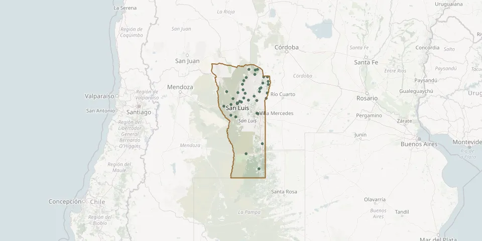 © OpenStreetMap
- Alto Pencoso Municipal CemeteryGPS coordinates: 33.42157° S, 66.93249° W
- Anchorena CemeteryGPS coordinates: 35.67556° S, 65.39856° W
- Balde CemeteryGPS coordinates: 33.35809° S, 66.62409° W
- Balde de Escudero CemeteryGPS coordinates: 32.09058° S, 65.55847° W
- Beazley CemeteryGPS coordinates: 33.74586° S, 66.62784° W
- Buena Esperanza Municipal CemeteryGPS coordinates: 34.77554° S, 65.25021° W
- Candelaria CemeteryGPS coordinates: 32.06389° S, 65.83958° W
- Cemeterio San JoseGPS coordinates: 33.30737° S, 66.35042° W
- Concarán CemeteryGPS coordinates: 32.56901° S, 65.23198° W
- Cortaderas CemeteryGPS coordinates: 32.51055° S, 64.99385° W
- Del Rosario CemeteryGPS coordinates: 32.48174° S, 66.06261° W
- El Trapiche CemeteryGPS coordinates: 33.12014° S, 66.06611° W
- El Volcán CemeteryGPS coordinates: 33.26564° S, 66.16835° W
- Jardín del Recuerdo San Luis Park CemeteryGPS coordinates: 33.32603° S, 66.35140° W
- Jardín del Sol Park CemeteryGPS coordinates: 33.67446° S, 65.49489° W
- La Calera CemeteryGPS coordinates: 32.88494° S, 66.81404° W
- La Carolina CemeteryGPS coordinates: 32.81598° S, 66.09355° W
- La Punilla CemeteryGPS coordinates: 33.13287° S, 65.08550° W
- La Quebrada Park CemeteryGPS coordinates: 33.24409° S, 66.23852° W
- Las Palomas CemeteryGPS coordinates: 32.06637° S, 65.46641° W
- La Toma CemeteryGPS coordinates: 33.05025° S, 65.60989° W
- Los Pinos Municipal CemeteryGPS coordinates: 33.20092° S, 65.85794° W
- Naschel CemeteryGPS coordinates: 32.88718° S, 65.37307° W
- Nogolí CemeteryGPS coordinates: 32.92280° S, 66.32250° W
- Paso del Rey CemeteryGPS coordinates: 32.94701° S, 66.00404° W
- Renca CemeteryGPS coordinates: 32.77381° S, 65.36035° W
- Sagrado Corazón de Jesús Municipal CemeteryGPS coordinates: 32.36455° S, 65.95200° W
- San Jerónimo CemeteryGPS coordinates: 33.14561° S, 66.53265° W
- San José CemeteryGPS coordinates: 33.31052° S, 66.33769° W
- San José del Morro CemeteryGPS coordinates: 33.21216° S, 65.49468° W