
Queensland
364 known cemeteries in Queensland, Australia.
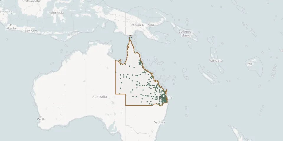 © OpenStreetMap
- Home Hill CemeteryGPS coordinates: 19.66366° S, 147.42693° E
- Howard CemeteryGPS coordinates: 25.30536° S, 152.54737° E
- Hoya/Boonah Baptist CemeteryGPS coordinates: 27.98775° S, 152.67821° E
- Hoya Lutheran CemeteryGPS coordinates: 27.96927° S, 152.69502° E
- Hughenden CemeteryGPS coordinates: 20.84146° S, 144.17328° E
- Iama Island CemeteryGPS coordinates: 9.89886° S, 142.77427° E
- Ilfracombe CemeteryGPS coordinates: 23.49222° S, 144.50014° E
- Ingham (New) CemeteryGPS coordinates: 18.67083° S, 146.19281° E
- Inglewood CemeteryGPS coordinates: 28.42745° S, 151.09109° E
- Injune CemeteryGPS coordinates: 25.85069° S, 148.55665° E
- Innisfail CemeteryGPS coordinates: 17.53144° S, 146.02755° E
- Ipswich General CemeteryGPS coordinates: 27.63223° S, 152.76054° E
- Irvinebank CemeteryGPS coordinates: 17.43339° S, 145.19360° E
- Isisford CemeteryGPS coordinates: 24.27477° S, 144.43263° E
- Jambin CemeteryGPS coordinates: 24.16530° S, 150.37133° E
- Jandowae CemeteryGPS coordinates: 26.77813° S, 151.12463° E
- Jericho CemeteryGPS coordinates: 23.60830° S, 146.12868° E
- Julia Creek CemeteryGPS coordinates: 20.64730° S, 141.73626° E
- Jundah CemeteryGPS coordinates: 24.83584° S, 143.07090° E
- Kalbar Engelsburg Baptist CemeteryGPS coordinates: 27.94092° S, 152.63248° E
- Kalbar General CemeteryGPS coordinates: 27.92593° S, 152.62500° E
- Karumba CemeteryGPS coordinates: 17.46203° S, 140.83448° E
- Kerry Saint Johns Catholic CemeteryGPS coordinates: 28.12783° S, 153.04417° E
- Kilcoy CemeteryGPS coordinates: 26.94541° S, 152.54311° E
- Kilkivan CemeteryGPS coordinates: 26.10739° S, 152.27651° E
- Killarney CemeteryGPS coordinates: 28.34806° S, 152.27446° E
- Kingaroy CemeteryGPS coordinates: 26.57932° S, 151.82660° E
- Kingston Pioneer CemeteryGPS coordinates: 27.66393° S, 153.11159° E
- Kumbia CemeteryGPS coordinates: 26.70077° S, 151.64660° E
- Kuranda CemeteryGPS coordinates: 16.81679° S, 145.63207° E