
South Australia
430 known cemeteries in South Australia, Australia.
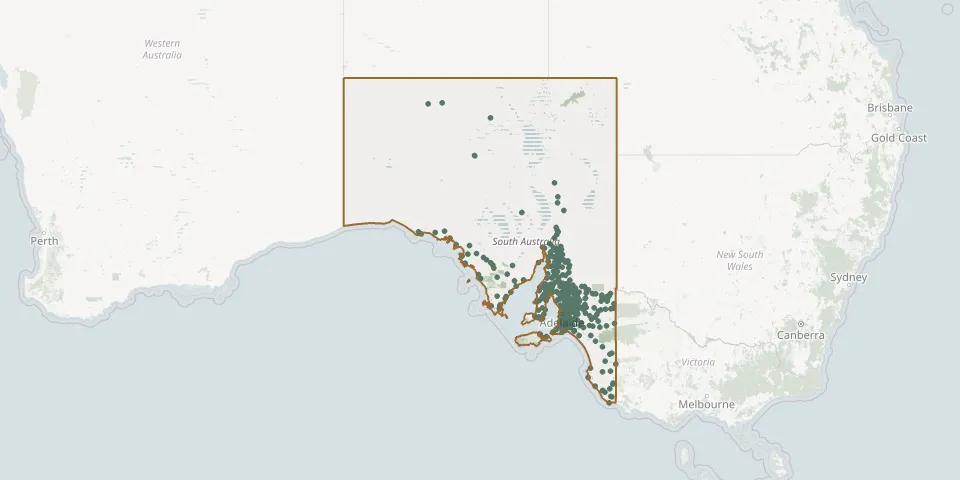 © OpenStreetMap
- Sandalwood CemeteryGPS coordinates: 34.93481° S, 140.12515° E
- Sanderston CemeteryGPS coordinates: 34.75332° S, 139.21654° E
- Sandleton (Saint Paul) Lutheran CemeteryGPS coordinates: 34.43400° S, 139.37233° E
- Schoenfeld Lutheran CemeteryGPS coordinates: 34.43022° S, 138.79642° E
- Schomburgk Holy Trinity Lutheran CemeteryGPS coordinates: 33.92399° S, 139.47201° E
- Scott Creek CemeteryGPS coordinates: 35.06678° S, 138.69478° E
- Sedan Lutheran CemeteryGPS coordinates: 34.57474° S, 139.29405° E
- Sevenhill (Saint Aloysius) Catholic CemeteryGPS coordinates: 33.88421° S, 138.63223° E
- Sherlock CemeteryGPS coordinates: 35.32467° S, 139.80450° E
- Siegersdorf Lutheran CemeteryGPS coordinates: 34.49748° S, 138.98420° E
- Smithfield Memorial ParkGPS coordinates: 34.65797° S, 138.71449° E
- Smoky Bay CemeteryGPS coordinates: 32.37366° S, 133.94191° E
- Snowtown-Condowie CemeteryGPS coordinates: 33.77698° S, 138.27559° E
- South Hummocks CemeteryGPS coordinates: 34.03398° S, 138.13885° E
- South Kilkerran Saint John Lutheran ChurchyardGPS coordinates: 34.43013° S, 137.60308° E
- South Rhine Presbyterian CemeteryGPS coordinates: 34.69030° S, 139.11971° E
- Spalding CemeteryGPS coordinates: 33.49004° S, 138.63257° E
- Spring Farm Wesleyan Methodist CemeteryGPS coordinates: 33.86319° S, 138.63916° E
- Springfield Bible Christian CemeteryGPS coordinates: 34.12497° S, 138.87709° E
- Springton Salt Creek Zion Baptist CemeteryGPS coordinates: 34.72245° S, 139.12743° E
- Stansbury CemeteryGPS coordinates: 34.91877° S, 137.79335° E
- St. George's Anglican Church CemeteryGPS coordinates: 34.87518° S, 138.95735° E
- Stirling CemeteryGPS coordinates: 35.02109° S, 138.75270° E
- Stirling North Garden CemeteryGPS coordinates: 32.51541° S, 137.82508° E
- St Josephs Catholic CemeteryGPS coordinates: 35.27624° S, 138.55727° E
- St. Jude's Anglican Cemetery, BrightonGPS coordinates: 35.01693° S, 138.52526° E
- Stockport CemeteryGPS coordinates: 34.33697° S, 138.74093° E
- Stockwell (Saint Thomas) Lutheran ChurchyardGPS coordinates: 34.43398° S, 139.05196° E
- Stonefield CemeteryGPS coordinates: 34.34640° S, 139.30240° E
- Strathalbyn CemeteryGPS coordinates: 35.26571° S, 138.90245° E