
Burgenland
341 known cemeteries in Burgenland, Austria.
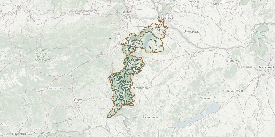 © OpenStreetMap
- Eisenstadt CemeteryGPS coordinates: 47.84596° N, 16.52976° E
- Großhöflein CemeteryGPS coordinates: 47.83624° N, 16.47749° E
- Müllendorf CemeteryGPS coordinates: 47.83783° N, 16.45791° E
- Leithaprodersdorf CemeteryGPS coordinates: 47.92894° N, 16.45793° E
- Oberberg-Eisenstadt CemeteryGPS coordinates: 47.84274° N, 16.50696° E
- Kleinhöflein CemeteryGPS coordinates: 47.84236° N, 16.50449° E
- Ort des Friedens SiegendorfGPS coordinates: 47.77767° N, 16.54191° E
- Woppendorf CemeteryGPS coordinates: 47.20647° N, 16.39233° E
- Deutsch Schuetzen CemeteryGPS coordinates: 47.16619° N, 16.44698° E
- Oberpetersdorf CemeteryGPS coordinates: 47.61365° N, 16.37902° E
- Kleinpetersdorf CemeteryGPS coordinates: 47.21845° N, 16.33735° E
- Tobaj CemeteryGPS coordinates: 47.09376° N, 16.30602° E
- Markt Sankt Martin Castle CemeteryGPS coordinates: 47.56250° N, 16.34637° E
- Antau CemeteryGPS coordinates: 47.76797° N, 16.47188° E
- Hornstein CemeteryGPS coordinates: 47.87686° N, 16.45234° E
- Podersdorf CemeteryGPS coordinates: 47.85493° N, 16.83898° E
- Wulkaprodersdorf CemeteryGPS coordinates: 47.79344° N, 16.49125° E
- Allersdorf CemeteryGPS coordinates: 47.30153° N, 16.31619° E
- Althodis CemeteryGPS coordinates: 47.31165° N, 16.38157° E
- Altschlaining CemeteryGPS coordinates: 47.31217° N, 16.28986° E
- Altschlaining New Jewish CemeteryGPS coordinates: 47.32147° N, 16.27205° E
- Andau CemeteryGPS coordinates: 47.77331° N, 17.02918° E
- Apetlon CemeteryGPS coordinates: 47.74645° N, 16.82944° E
- Aschau CemeteryGPS coordinates: 47.39993° N, 16.20789° E
- Badersdorf CemeteryGPS coordinates: 47.19600° N, 16.37769° E
- Bad Sauerbrunn CemeteryGPS coordinates: 47.77812° N, 16.33578° E
- Bad Sauerbrunn Jewish CemeteryGPS coordinates: 47.77776° N, 16.33563° E
- Bad Tatzmannsdorf Village CemeteryGPS coordinates: 47.33003° N, 16.22646° E
- Baumgarten CemeteryGPS coordinates: 47.73461° N, 16.50269° E
- Bergwerk CemeteryGPS coordinates: 47.35952° N, 16.25040° E