
Carinthia
442 known cemeteries in Carinthia, Austria.
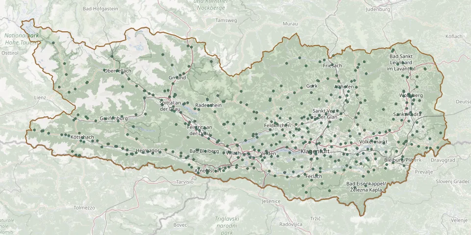 © OpenStreetMap
- Unterhaus CemeteryGPS coordinates: 46.83358° N, 13.51741° E
- Unterloibl CemeteryGPS coordinates: 46.51199° N, 14.28793° E
- VeitskircheGPS coordinates: 46.58295° N, 14.53817° E
- Velden am Wörthersee CemeteryGPS coordinates: 46.61696° N, 14.03768° E
- Villach Central CemeteryGPS coordinates: 46.61483° N, 13.86470° E
- Villach Woodland CemeteryGPS coordinates: 46.62110° N, 13.82320° E
- Völkermarkt Town Cemetery and Cemetery ChapelGPS coordinates: 46.65859° N, 14.64232° E
- Wabelsdorf CemeteryGPS coordinates: 46.65638° N, 14.50968° E
- Waidegg CemeteryGPS coordinates: 46.63448° N, 13.23031° E
- Waiern ChurchyardGPS coordinates: 46.73187° N, 14.08396° E
- Waiern Evangelical CemeteryGPS coordinates: 46.73177° N, 14.08552° E
- Watschig CemeteryGPS coordinates: 46.61716° N, 13.30596° E
- Weitensfeld im Gurktal ChurchyardGPS coordinates: 46.84852° N, 14.19155° E
- Wellersdorf ChurchyardGPS coordinates: 46.54372° N, 14.18487° E
- Wieting CemeteryGPS coordinates: 46.86963° N, 14.53830° E
- Wölfnitz an der Saualpe ChurchyardGPS coordinates: 46.78436° N, 14.68981° E
- Wolfsberg Town CemeteryGPS coordinates: 46.83263° N, 14.84364° E
- Würmlach CemeteryGPS coordinates: 46.65960° N, 13.01313° E
- Zedlitzdorf CemeteryGPS coordinates: 46.80238° N, 13.92421° E
- Zell-Pfarre/Sele-CerkevGPS coordinates: 46.47120° N, 14.38740° E
- Zelsach CemeteryGPS coordinates: 46.85494° N, 13.46515° E
- Zlan CemeteryGPS coordinates: 46.72961° N, 13.58071° E