
Styria
441 known cemeteries in Styria, Austria.
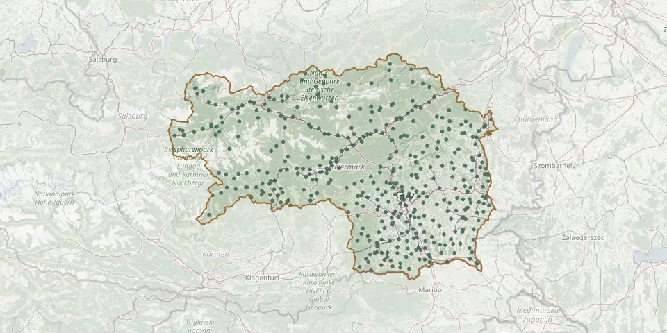 © OpenStreetMap
- Pfarrkirche St. DionysenGPS coordinates: 47.41549° N, 15.20549° E
- Pfarrkirche St. GeorgenGPS coordinates: 47.20688° N, 14.50013° E
- Pfarrkirche St. GeorgenGPS coordinates: 47.07949° N, 14.73937° E
- Pfarrkirche St. LorenzenGPS coordinates: 47.49459° N, 14.45482° E
- Pfarrkirche St. Lorenzen bei ScheiflingGPS coordinates: 47.14554° N, 14.40579° E
- Pfarrkirche St. Michael in ObersteiermarkGPS coordinates: 47.33770° N, 15.02189° E
- Pfarrkirche TrabochGPS coordinates: 47.37751° N, 14.98611° E
- Pfarrkirche WundschuhGPS coordinates: 46.92540° N, 15.44761° E
- Pfarrkirche ZeutschachGPS coordinates: 47.07077° N, 14.36770° E
- Piber CemeteryGPS coordinates: 47.08222° N, 15.10107° E
- Pinggau CemeteryGPS coordinates: 47.44362° N, 16.06932° E
- Pischelsdorf in der Steiermark CemeteryGPS coordinates: 47.16859° N, 15.80919° E
- Pittermann War CemeteryGPS coordinates: 47.42184° N, 15.78370° E
- Pölfing-Brunn CemeteryGPS coordinates: 46.73387° N, 15.29308° E
- Pöllauberg CemeteryGPS coordinates: 47.31618° N, 15.85739° E
- Pöllau CemeteryGPS coordinates: 47.29900° N, 15.82954° E
- Pöls CemeteryGPS coordinates: 47.21534° N, 14.58054° E
- Praunfalk Jewish CemeteryGPS coordinates: 47.61354° N, 13.79128° E
- Preding CemeteryGPS coordinates: 46.86272° N, 15.40799° E
- Predlitz-Turrach CemeteryGPS coordinates: 47.06931° N, 13.91306° E
- Privater CemeteryGPS coordinates: 47.11917° N, 15.90712° E
- Proleb CemeteryGPS coordinates: 47.39887° N, 15.13626° E
- Puch bei Weiz CemeteryGPS coordinates: 47.22753° N, 15.72945° E
- Pusterwald CemeteryGPS coordinates: 47.30834° N, 14.37501° E
- Rachau ChurchyardGPS coordinates: 47.21625° N, 14.91268° E
- Ramsau am Dachstein Evangelical CemeteryGPS coordinates: 47.42264° N, 13.65307° E
- Ranten CemeteryGPS coordinates: 47.16003° N, 14.08274° E
- Ratten CemeteryGPS coordinates: 47.48653° N, 15.72788° E
- Rein Eisbach CemeteryGPS coordinates: 47.13873° N, 15.28694° E
- Rettenegg CemeteryGPS coordinates: 47.52463° N, 15.77982° E