
Styria
441 known cemeteries in Styria, Austria.
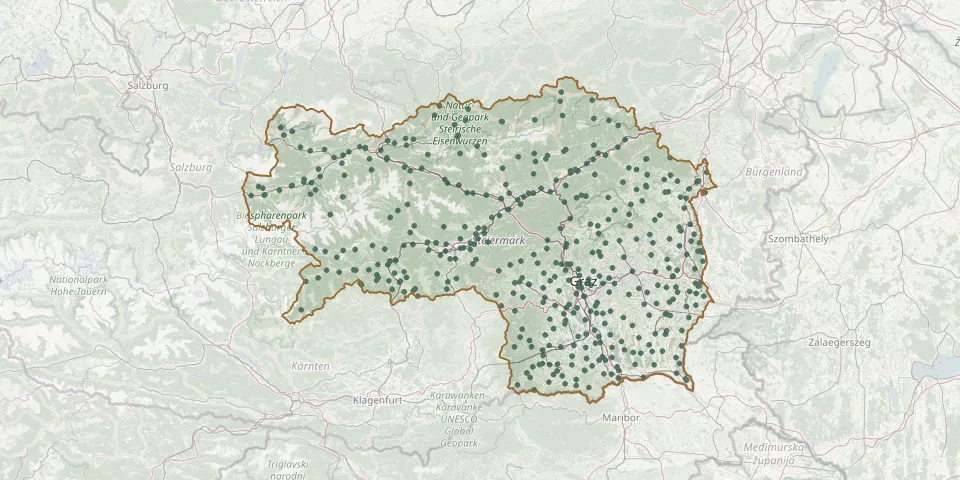 © OpenStreetMap
- Gußwerk CemeteryGPS coordinates: 47.73927° N, 15.30921° E
- Hainersdorf CemeteryGPS coordinates: 47.11165° N, 15.95268° E
- Halbenrain CemeteryGPS coordinates: 46.72474° N, 15.94844° E
- Hartberg Town CemeteryGPS coordinates: 47.27148° N, 15.96350° E
- Haselsdorf-Tobelbad CemeteryGPS coordinates: 46.98280° N, 15.35911° E
- Hatzendorf CemeteryGPS coordinates: 46.97483° N, 16.00267° E
- Hausmannstaetten CemeteryGPS coordinates: 46.99042° N, 15.51321° E
- Heiligenkreuz am Waasen CemeteryGPS coordinates: 46.95757° N, 15.58587° E
- Heimschuh CemeteryGPS coordinates: 46.75223° N, 15.48552° E
- Hengsberg CemeteryGPS coordinates: 46.87126° N, 15.45168° E
- Hetzendorf Jewish CemeteryGPS coordinates: 47.18246° N, 14.67892° E
- Hieflau Cemetery and Funeral HallGPS coordinates: 47.60743° N, 14.74466° E
- Hieflau War CemeteryGPS coordinates: 47.61397° N, 14.74827° E
- Hirschegg CemeteryGPS coordinates: 47.01942° N, 14.95860° E
- Hochwechsel German War CemeteryGPS coordinates: 47.52999° N, 15.91368° E
- Hollenegg CemeteryGPS coordinates: 46.79089° N, 15.21532° E
- Holy Cross Church Cemetery, RabenwaldGPS coordinates: 47.40373° N, 15.90335° E
- Ilz CemeteryGPS coordinates: 47.08873° N, 15.92986° E
- Ilz War CemeteryGPS coordinates: 47.08799° N, 15.92573° E
- Irdning CemeteryGPS coordinates: 47.50936° N, 14.11060° E
- Jagerberg CemeteryGPS coordinates: 46.85721° N, 15.74189° E
- Jakobskirche EnzelsdorfGPS coordinates: 46.95029° N, 15.50982° E
- Johnsbach Mountaineers' CemeteryGPS coordinates: 47.54186° N, 14.58222° E
- Judenburg CemeteryGPS coordinates: 47.16712° N, 14.65233° E
- Judendorf StrassengelGPS coordinates: 47.11125° N, 15.33914° E
- Jüdische Gräber am SteinbergGPS coordinates: 46.94141° N, 15.91446° E
- Kainach CemeteryGPS coordinates: 47.14444° N, 15.09360° E
- Kaindorf bei HartbergGPS coordinates: 47.22866° N, 15.91081° E
- Kalsdorf bei Graz CemeteryGPS coordinates: 46.95821° N, 15.47658° E
- Kalwang CemeteryGPS coordinates: 47.42750° N, 14.75335° E